
[vc_row][vc_column][vc_column_text]
Unless noted, all photographs are provided by Terry Casey.
 May 2012 – Looking south when Bryant Blvd (US-87) splits into Abe Street (heading south) and Koenigheim Street (heading north)
 February 2013 – Valero Gas Station is destroyed. A new Starbucks was built.
May 2012 – Looking south on Bryant heading towards Avenues L & N — Notice Pinkie’s (don’t have to head to Whiskey City for “hard” liquor). The other Pinkie’s is on Sherwood Way.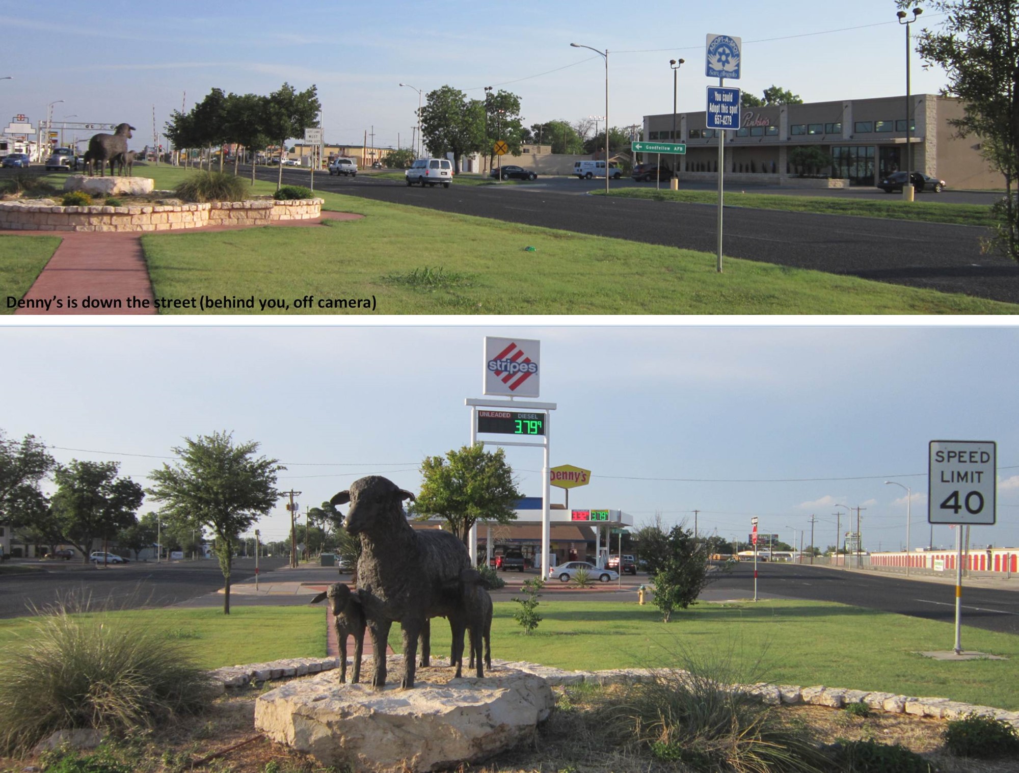 Bottom photograph is view driving north into the city. Looking north when Bryant Blvd (US-87) splits into Abe Street (heading south) and Koenigheim Street (heading north)
Top photograph was taken in 2012 Bottom photograph was taken in 2013 after they enlarged the building.
 June 2013 Fort Concho
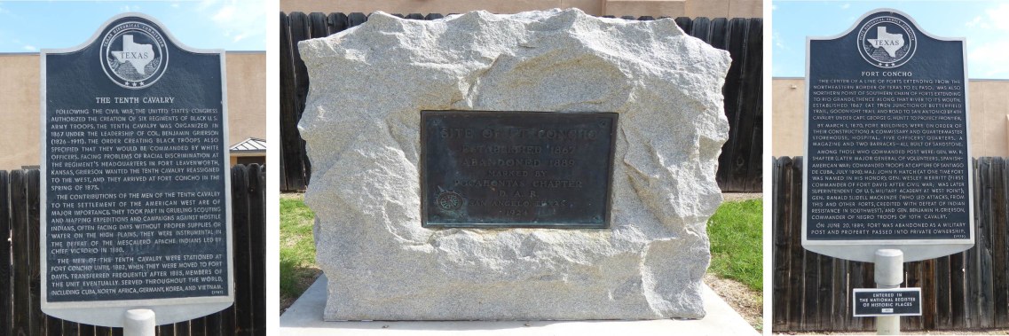
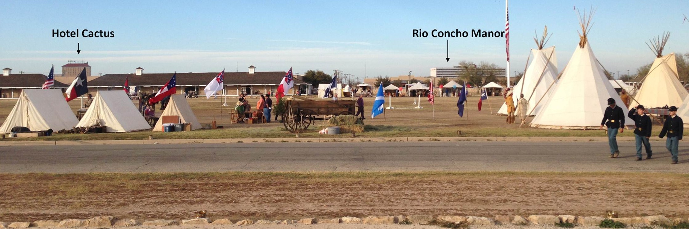
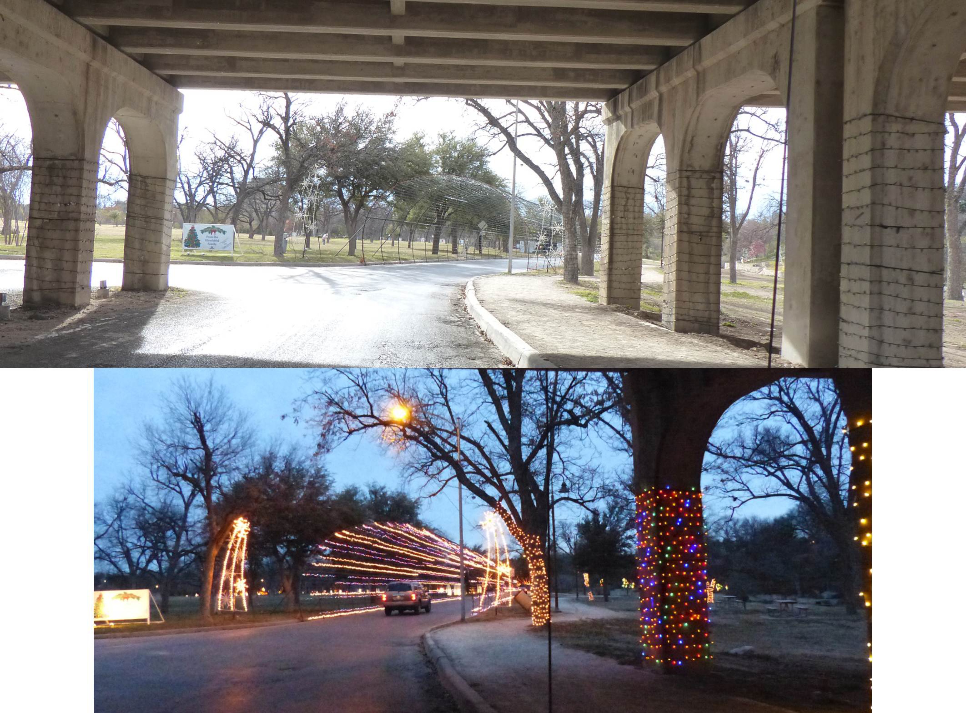
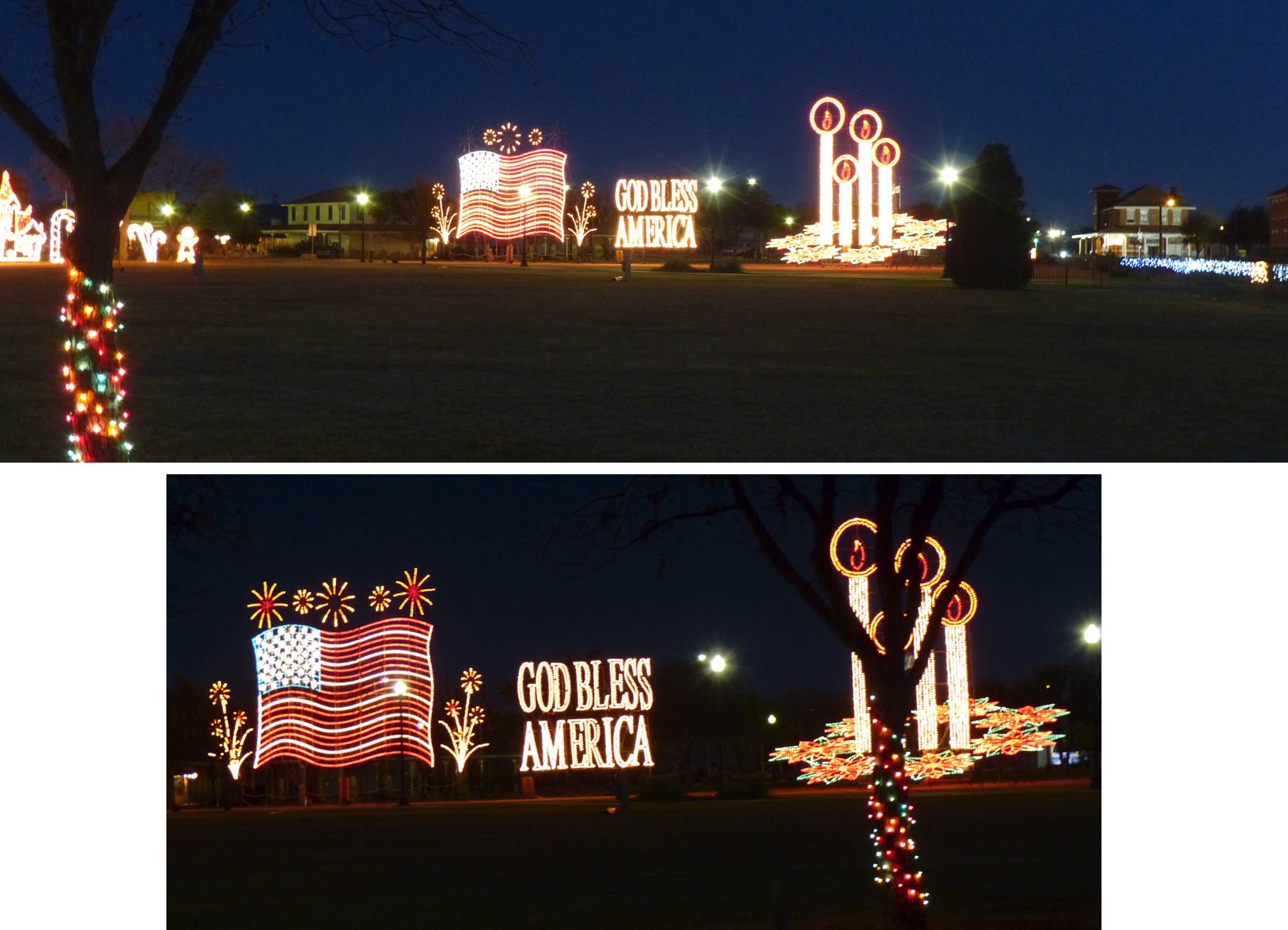
 Annual Christmas At Old Fort Concho (was held 6-9 December 2012).


 In September 2010, took a boat tour of Lake Nasworthy on west side of Knickerbocker bridge* that crosses Lake Nasworthy. The first photograph is the spillway and the other two photographs were just too pretty to not take a picture.
*The boat was too tall to allow us to tour the rest of the lake (the side that the GAFB Recreation Camp is on).
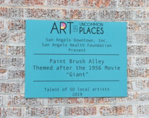
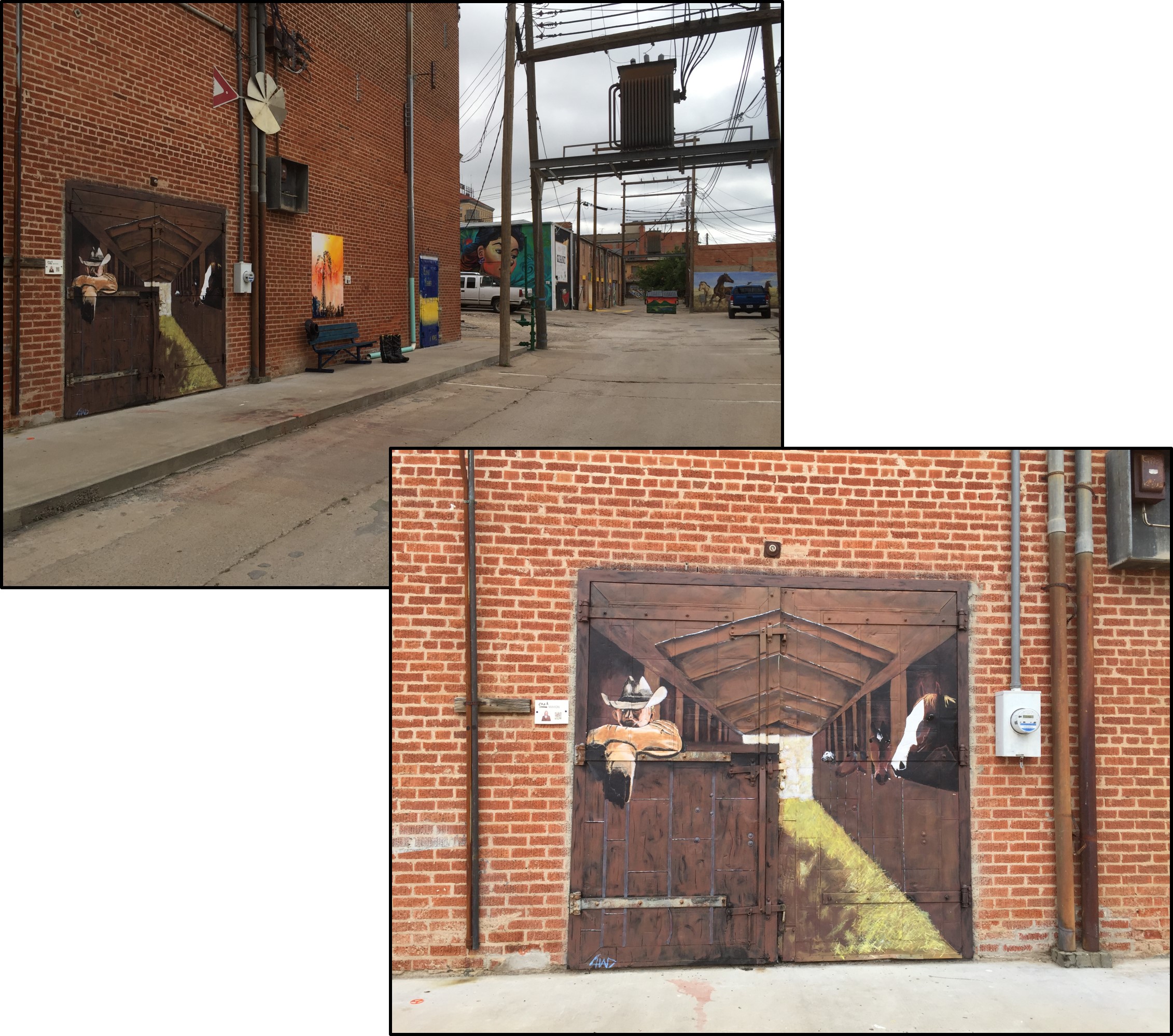
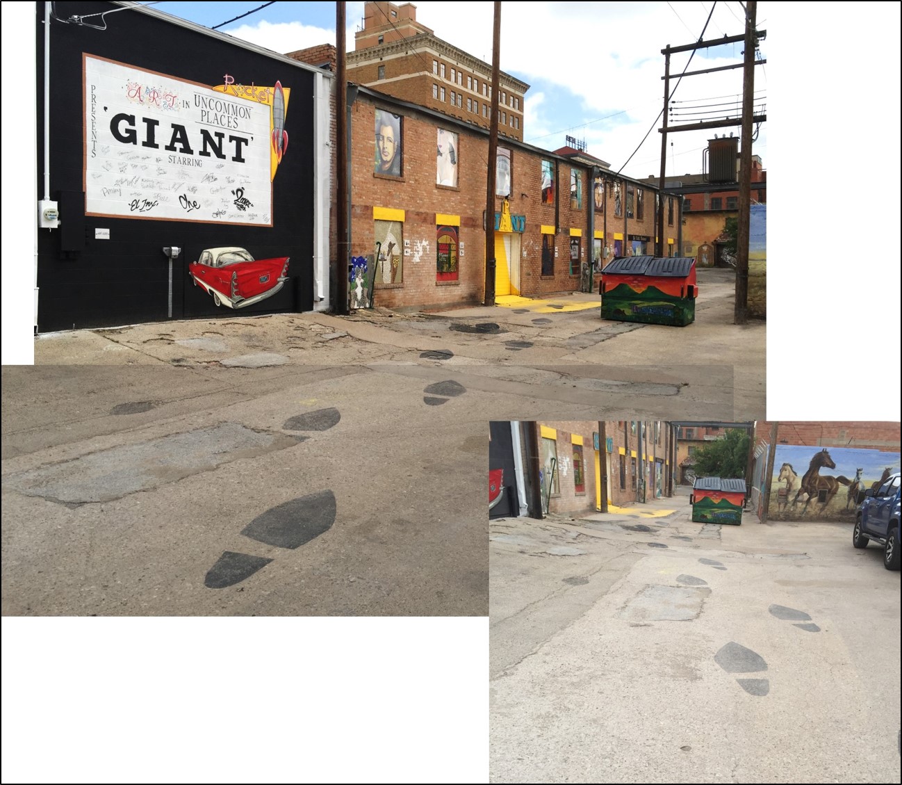
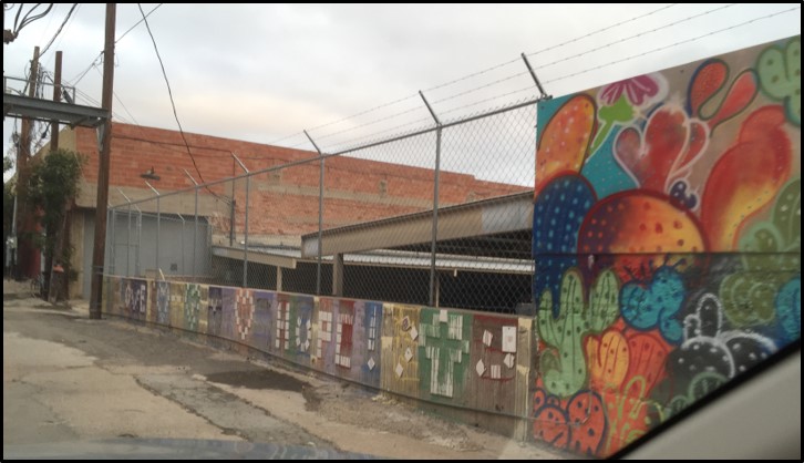
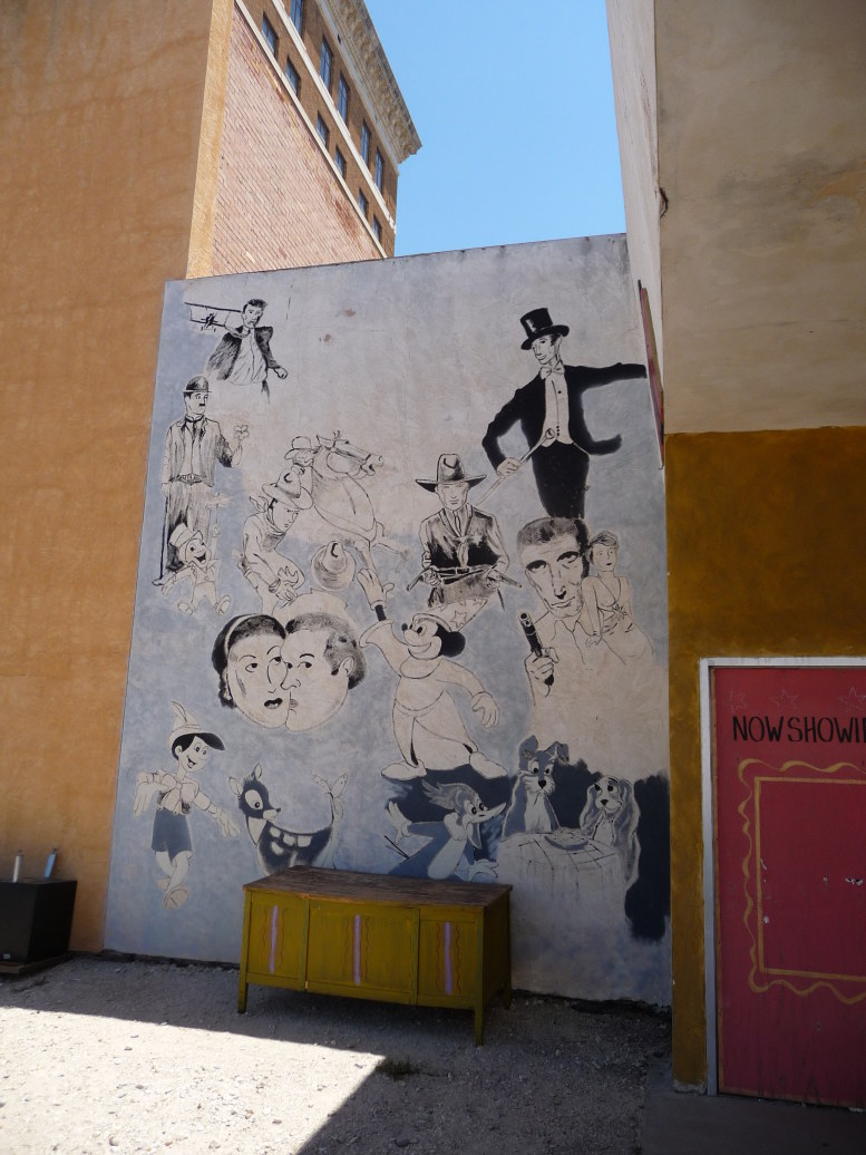
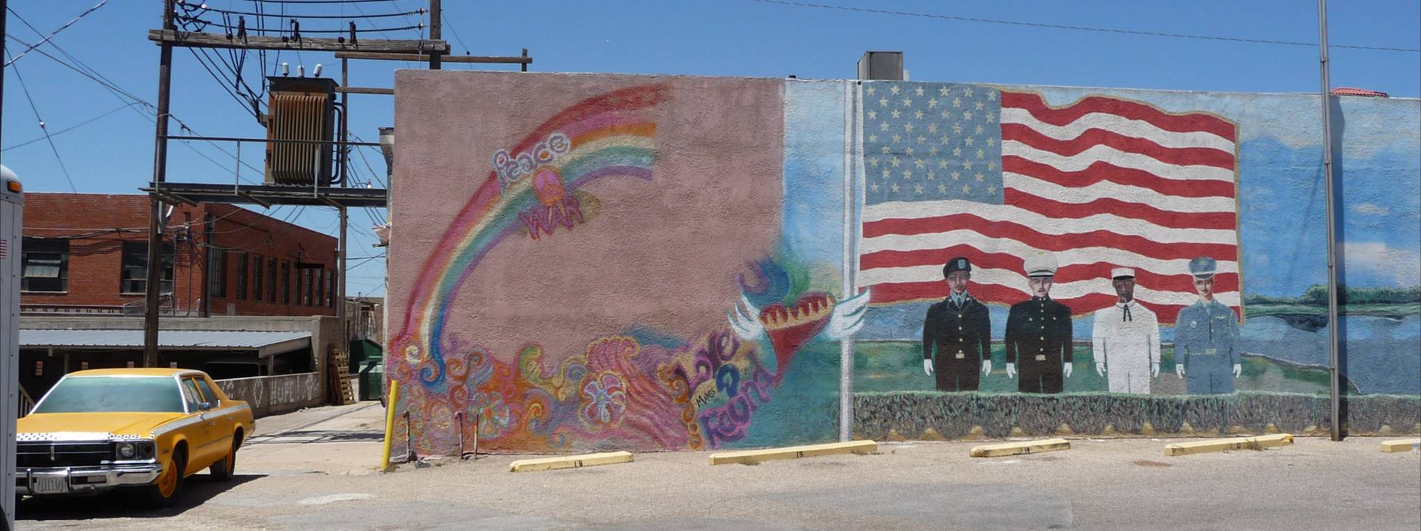
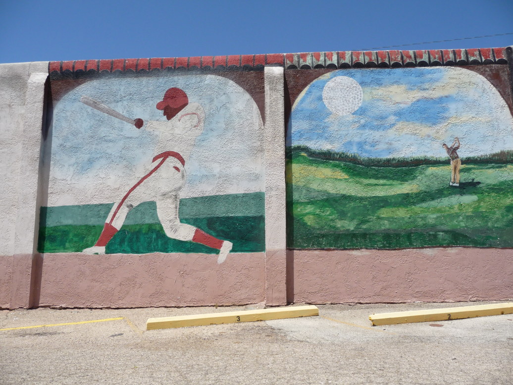
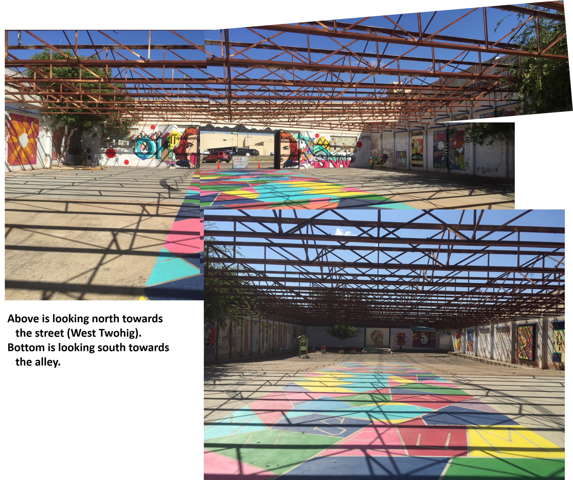
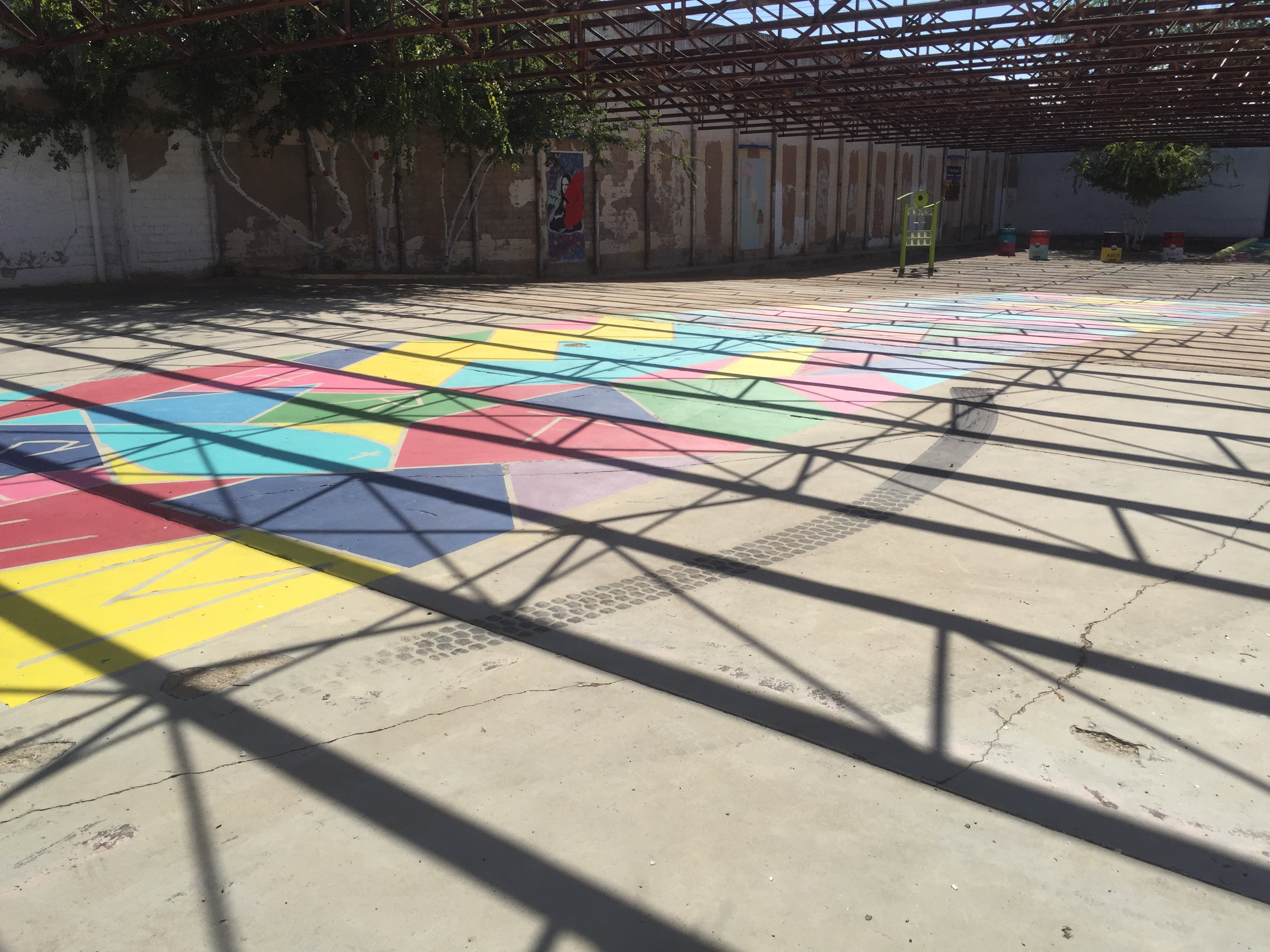
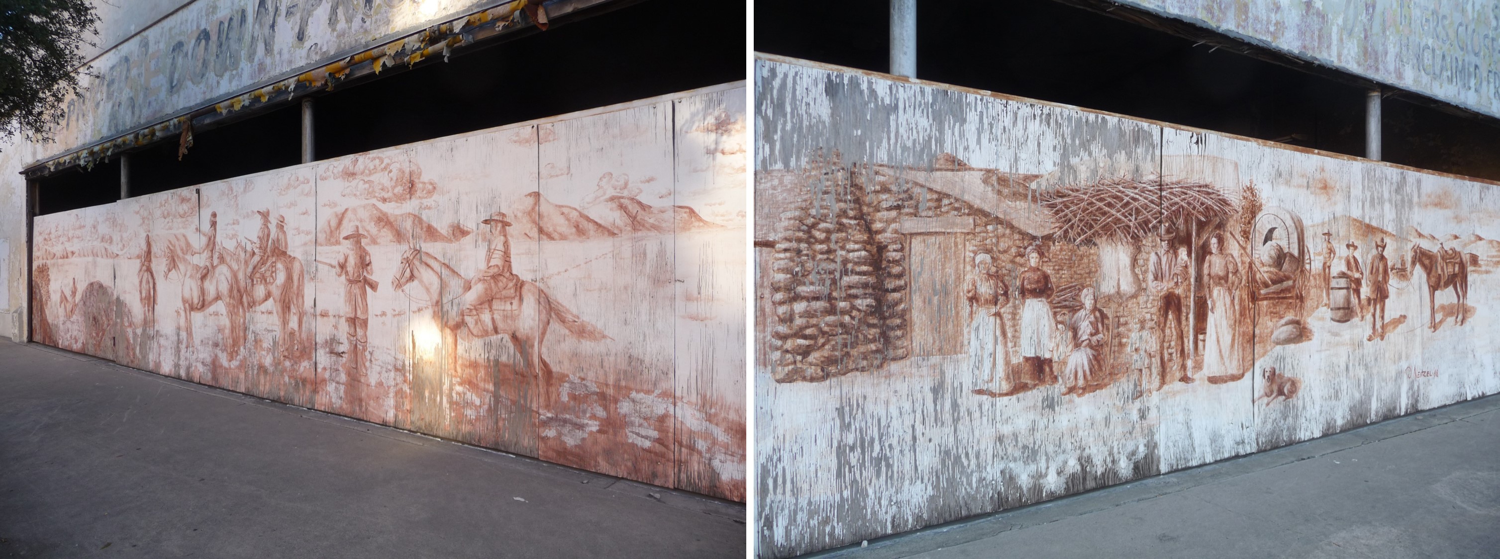
2005 and NOW 2019 – Artists turn an alley into fabulous artwork.

 9 May 2019
 9 May 2019
 9 May 2019
 9 May 2019
 9 May 2019 – Looking west towards the entrance to the alley, you can see the horse’s shadow sticking out in the background.
 9 May 2019
 2005
2005
 2005
2005


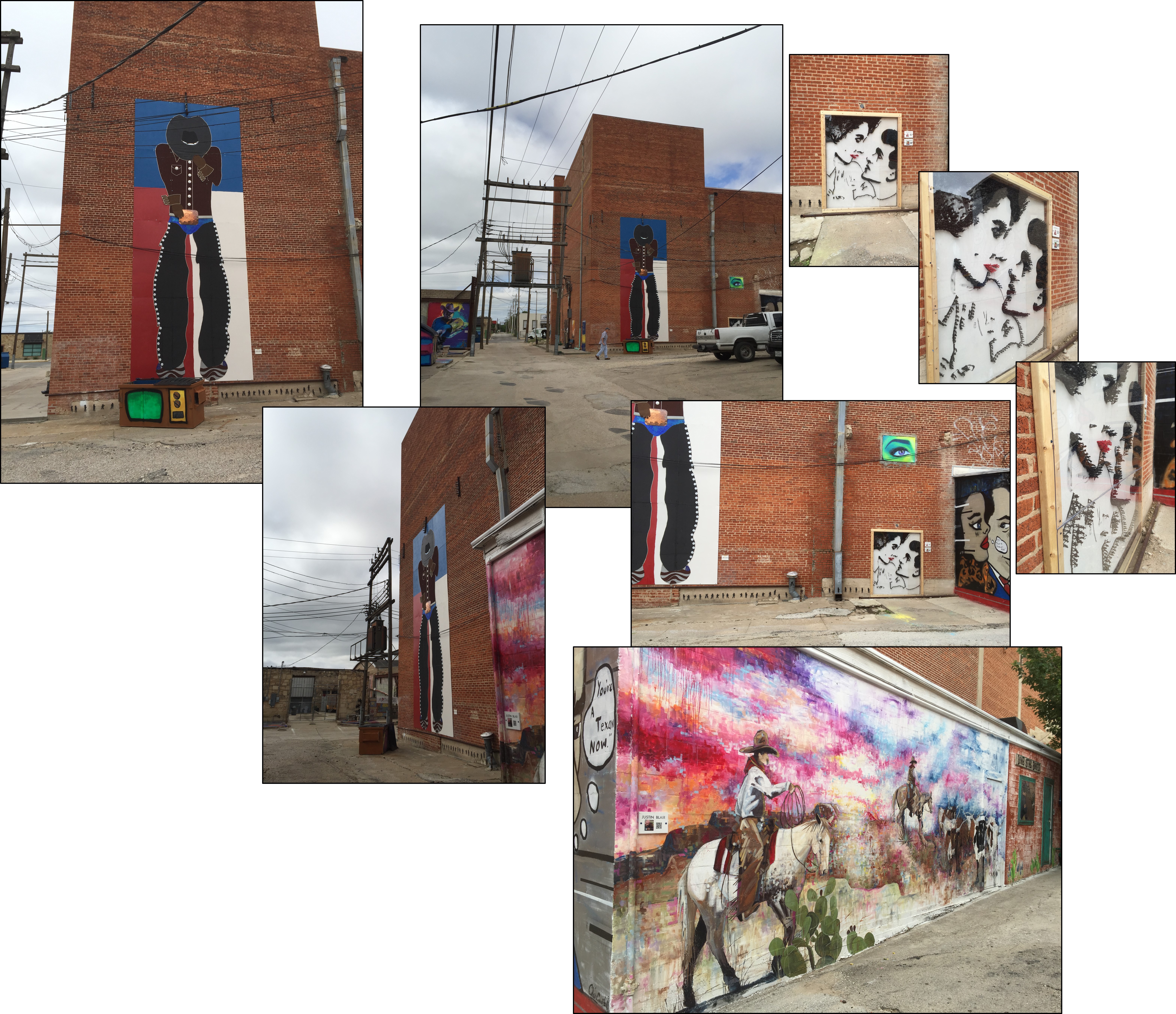
 The “tall Texan”, seen in next group of photographs, are directly opposite this trash bin (off camera on the right).
Also, the cowboy boots (below) along with other paintings that are located on the same side, next to this colorful trash container (on the left off camera) can be seen in the group of photographs below the “tall Texan”.
 9 May 2019
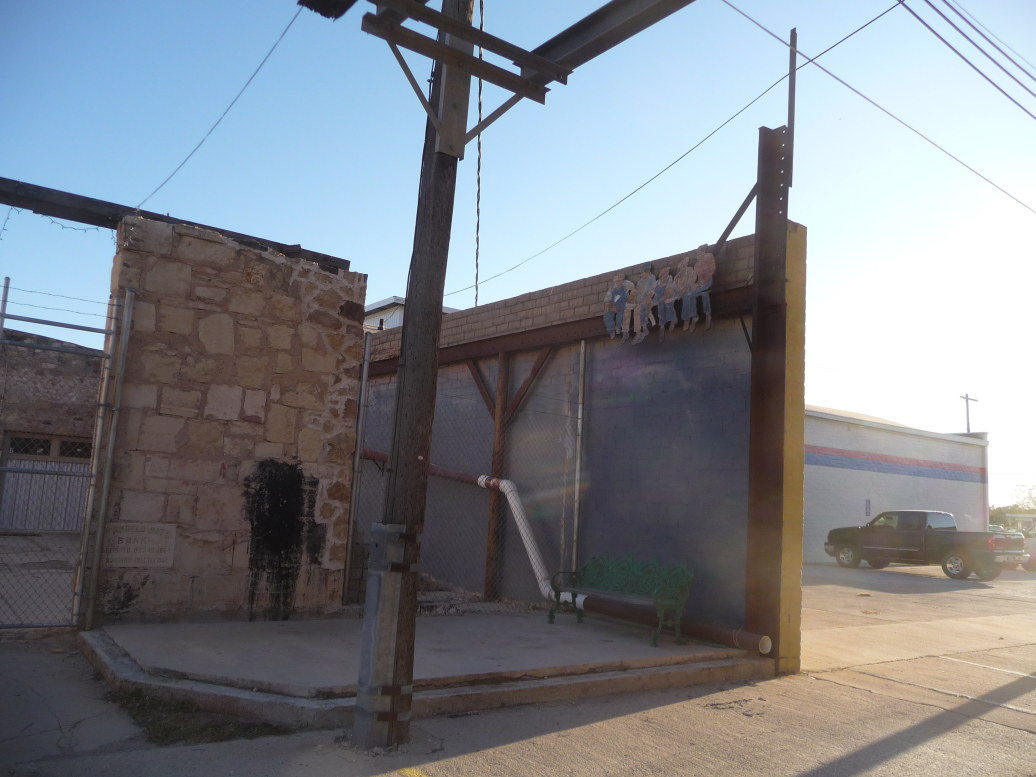
 In the next photograph you can see where there are more paintings inside a small walkway that is across the alley from the above paintings.
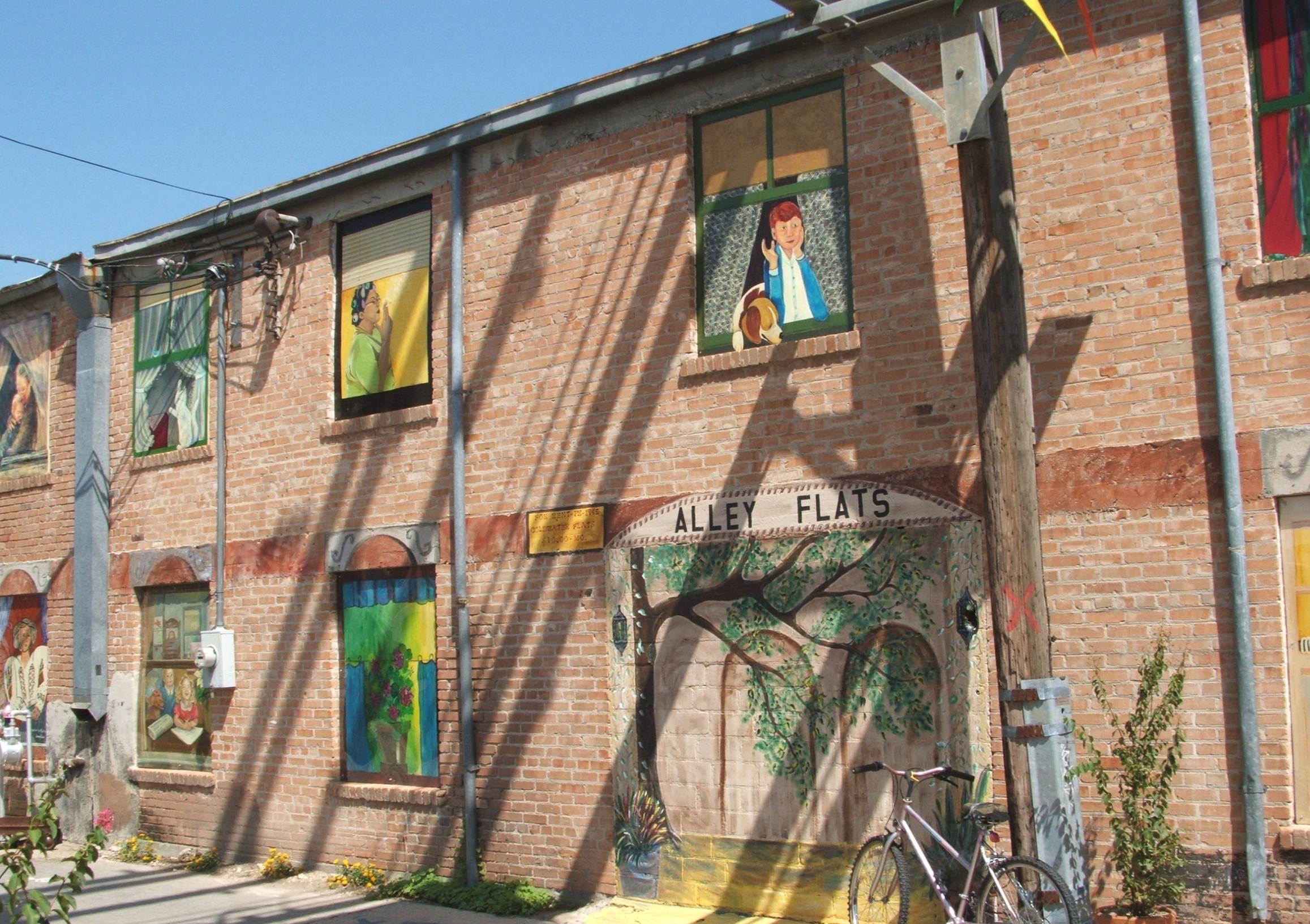
This is that same little walkway shown above (from a different angle) but, as it was in 2005. 2005
2005
 2005
2005
 2005
2005
 2005
2005

 9 May 2019
 2005
2005
 2005
2005
2019 – Now look what this area looks like now!


 2005
2005
 2005
2005
 2005
2005
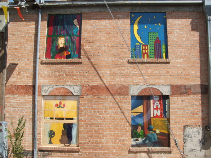 2005
2005
 2005 – Artists turn an alley into fabulous artwork (Check out dog “watering” the gravel.)
 2005
2005
 2005 – Artists turn an alley into fabulous artwork (I guess the old lady doesn’t like dancing.)
 2005
2005
 2005
2005
 2005
2005
 2019 – This is located opposite the paintings starting below.
The following photographs were taken in May of 2019.


 2019 – Even the bird on the nest is a piece of art!
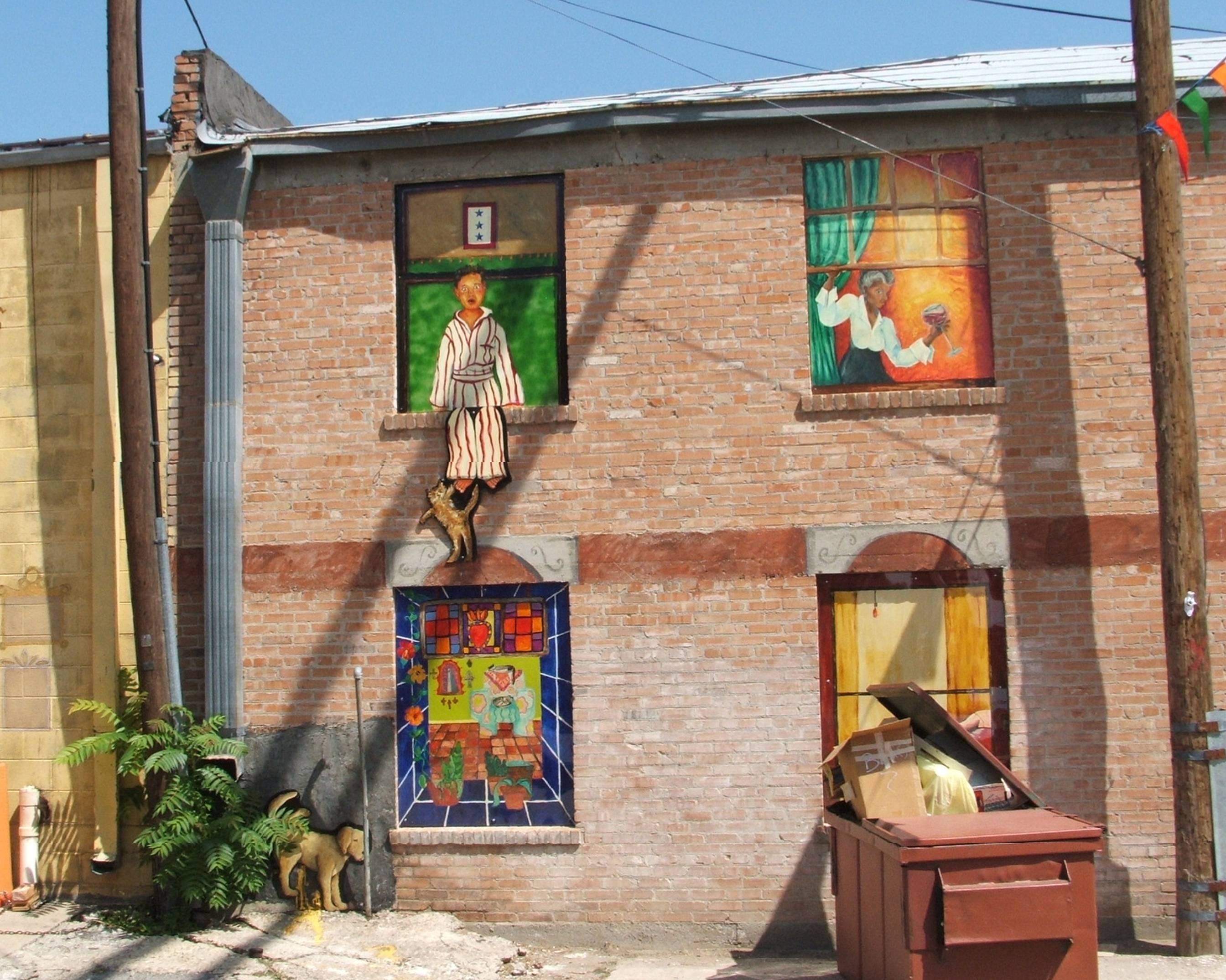
 2005
2005
 2005
2005
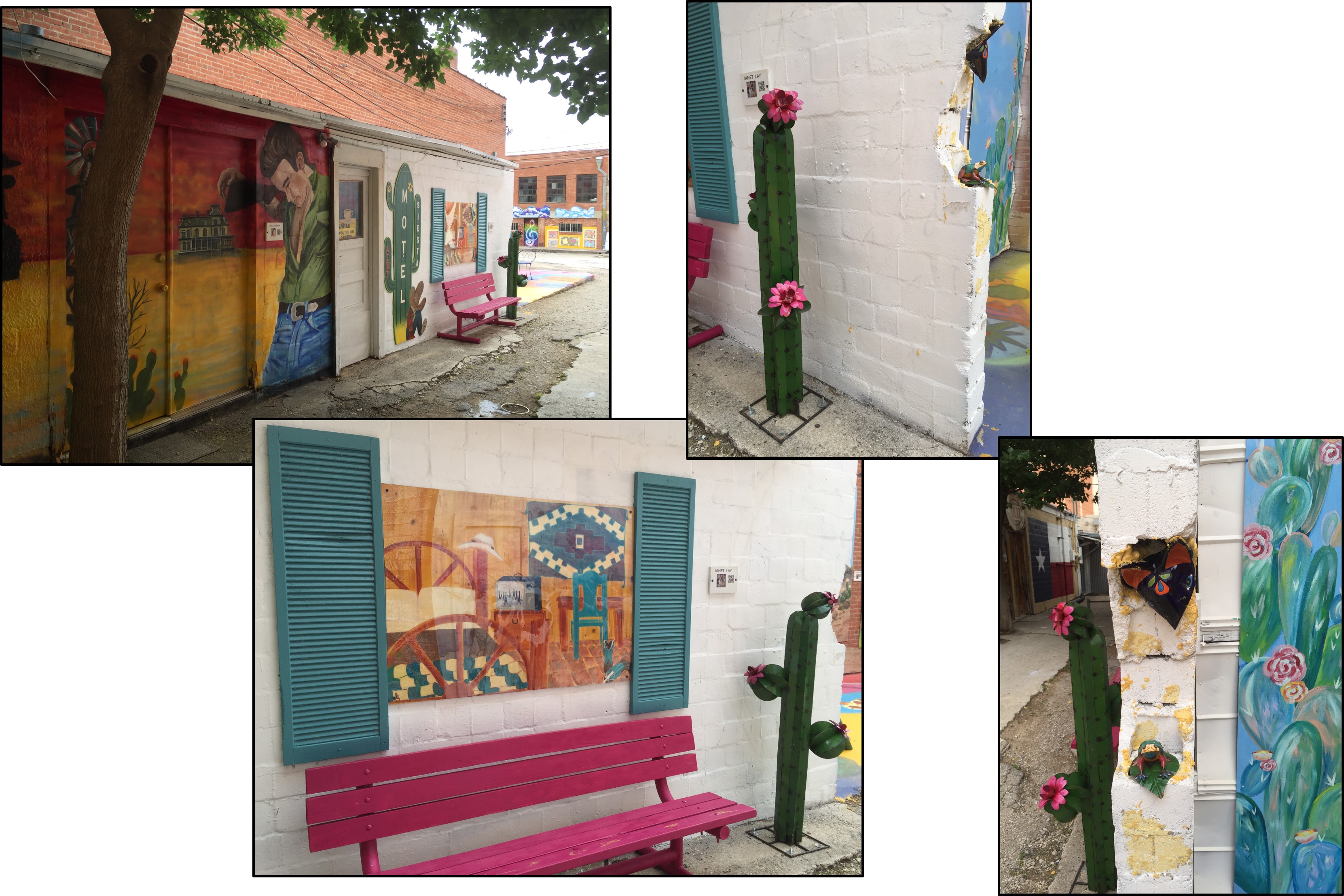
 2019 – This side has stayed pretty much as painted back in 2005. The opposite wall has been updated as shown below.
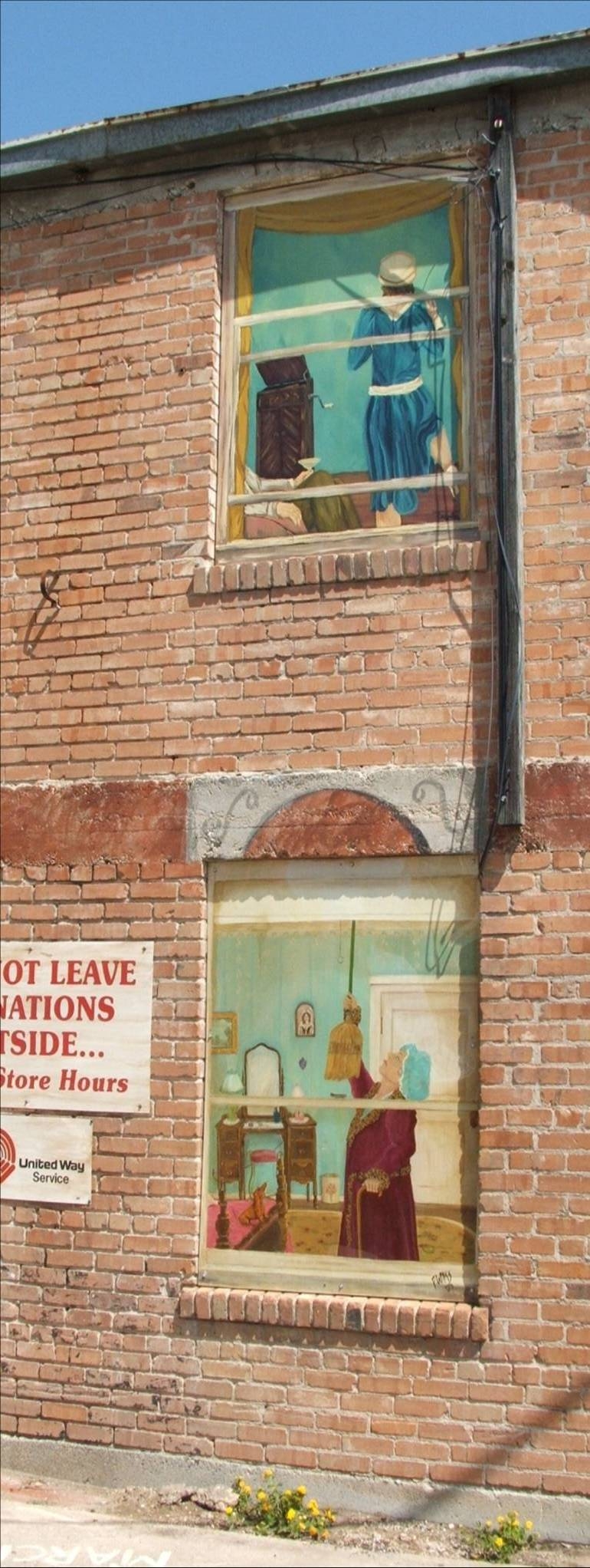
 2005 – Oops, I came back another day to get a closer photo but there is a cabinet in photo now.
 2005
2005 2019
2019
 2005
2005
 2005
2005
 2019 – I sure wish I could have gotten this shot in a closeup in one photograph.
 2019
2019
 2019
2019
Photograph provided by Ronald Firkel 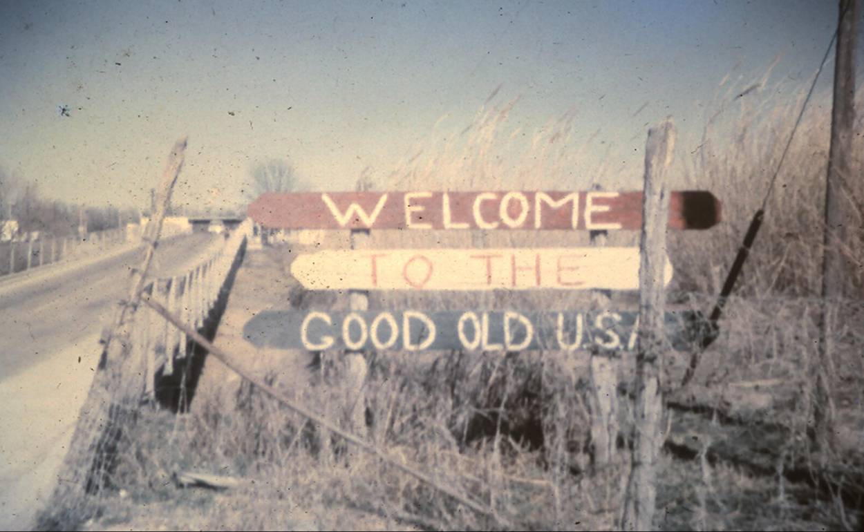 1963-1964 sign found in local area. Do you remember it?
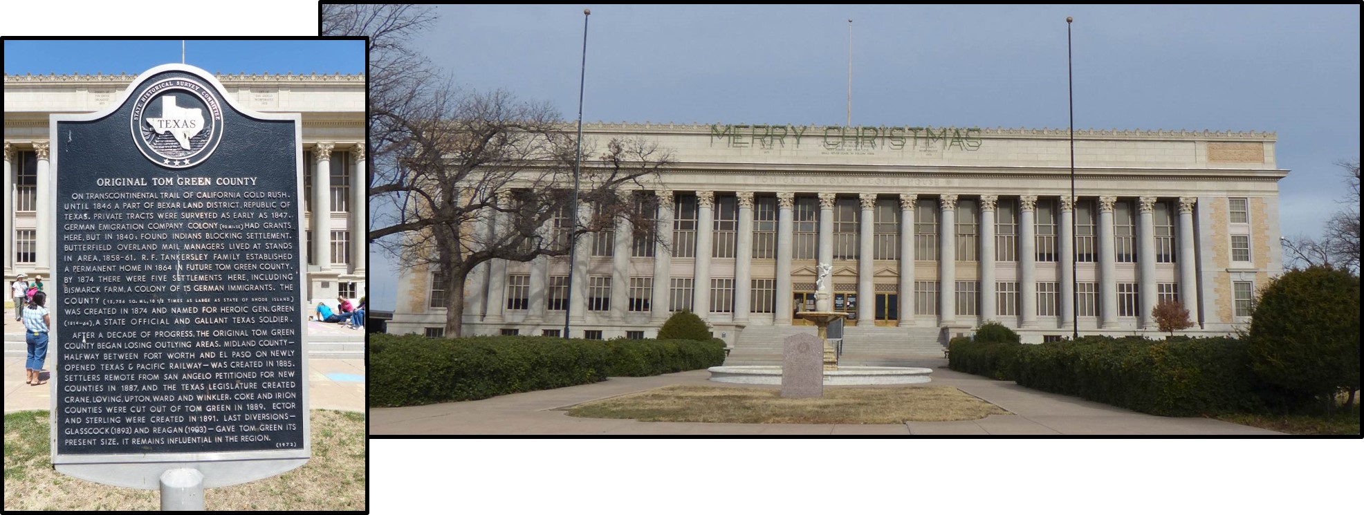 Tom Green County Courthouse
 2011 – Miss Hattie’s Bardello (if you look closely, you see an arm in the upstairs window).
 December 2013 – Eckert House is located at the corner of Koberlin Street and N Malone Street.
 October 2012 – St John’s Hospital is now Shannon St. John’s Campus.
 2012 – Beluh 42 on W Avenue N Shop sells skateboards, discgolf, body jewelry, clothes, shoes, etc.
 2012 – Front entrance to Beluh 42.


 25 November 2018 – Driving south on Hwy 87 (Bryant Blvd), you can see this Tattoo shop. Depending on where you are standing, you can see either a beautiful woman or a scary face.
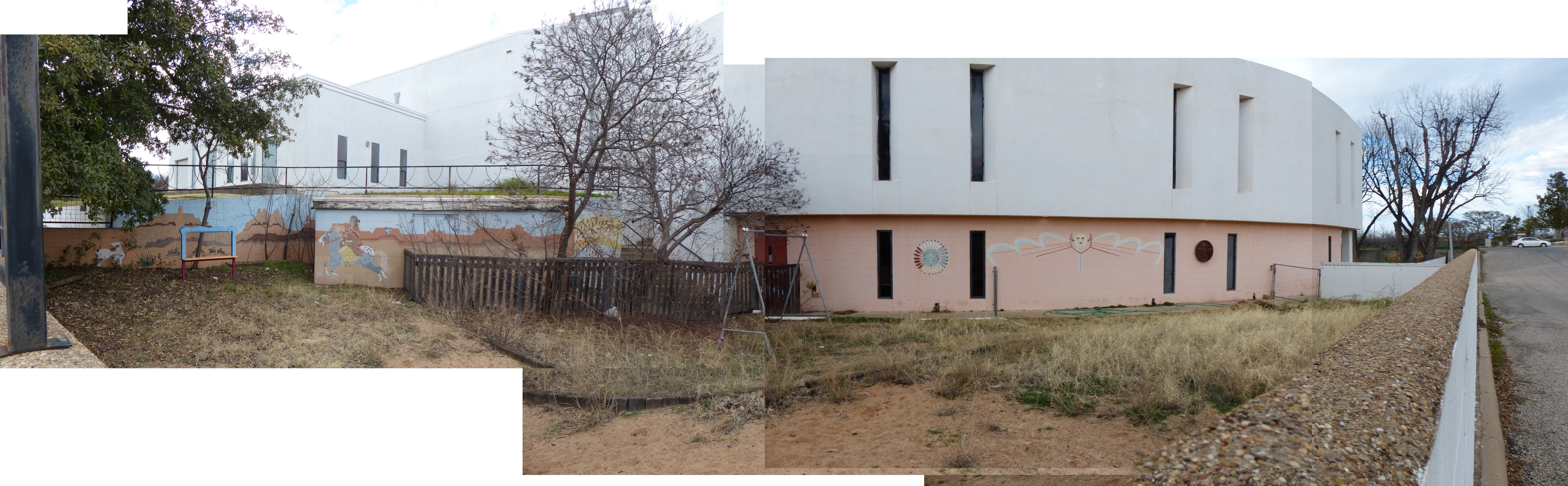
 2012 – The Central Freshman Campus (old Edison Jr High) is off camera behind you.
 2012 – Murals on side of building.
 2012 – The Central Freshman Campus (old Edison Jr High) is off camera behind you. The murals on the side of the buildings (previous photographs) are located on street to right of this photograph.
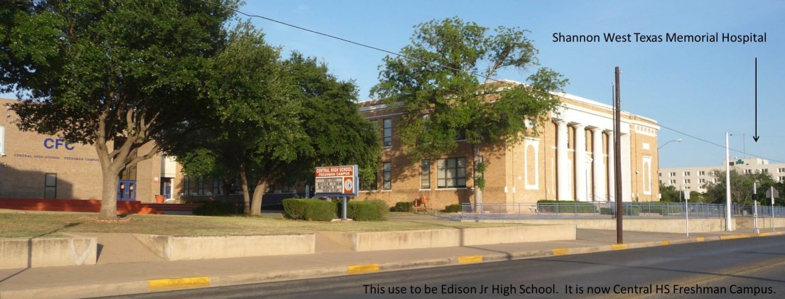 Use to be San Angelo High School; then, Edison Jr High. Now Central HS Freshman Campus.
Please checkout the following link:
https://www.historicmuralsofsanangelo.org/murals.html
 2009 – Bill’s Man Shop and Scramblers use to be the Woolworth building in 1972. Facing southeast – small two-story building on left (under tree) was the old Hemphill Wells building. In 1973, a Furr’s cafeteria was located in the basement. In 2011 the new library will move into this building and have three floors. (Check out the new beautiful library found in the You May Recall page.)


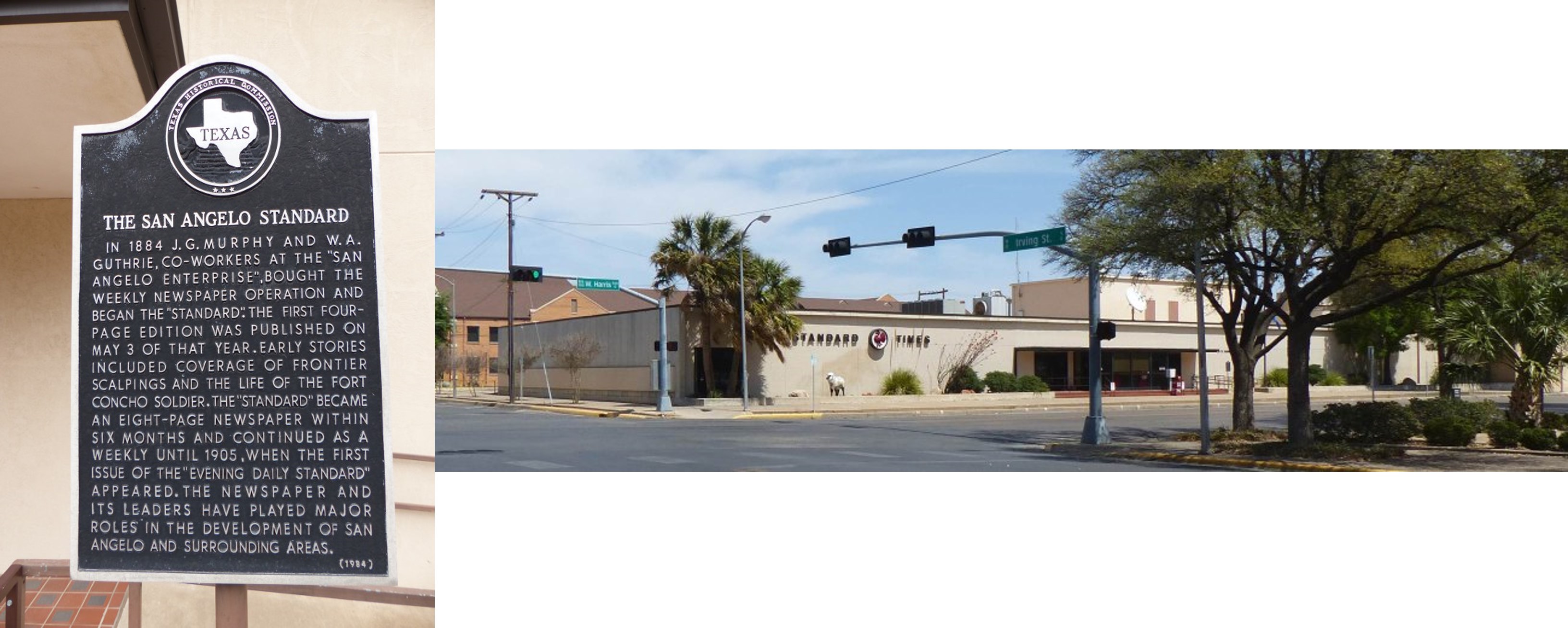 April 2013 – San Angelo Standard Times
 2009 – Front of Visitor Center located between Abe St/ Koenigheim St (Bryant Blvd) looking north
 2009 – Back of Visitor Center located between Abe St/ Koenigheim St (Bryant Blvd) looking south
 2011 – Standing on steps behind Visitor’s Center
 Annual Christmas At Old Fort Concho (was held 6-9 December 2012).
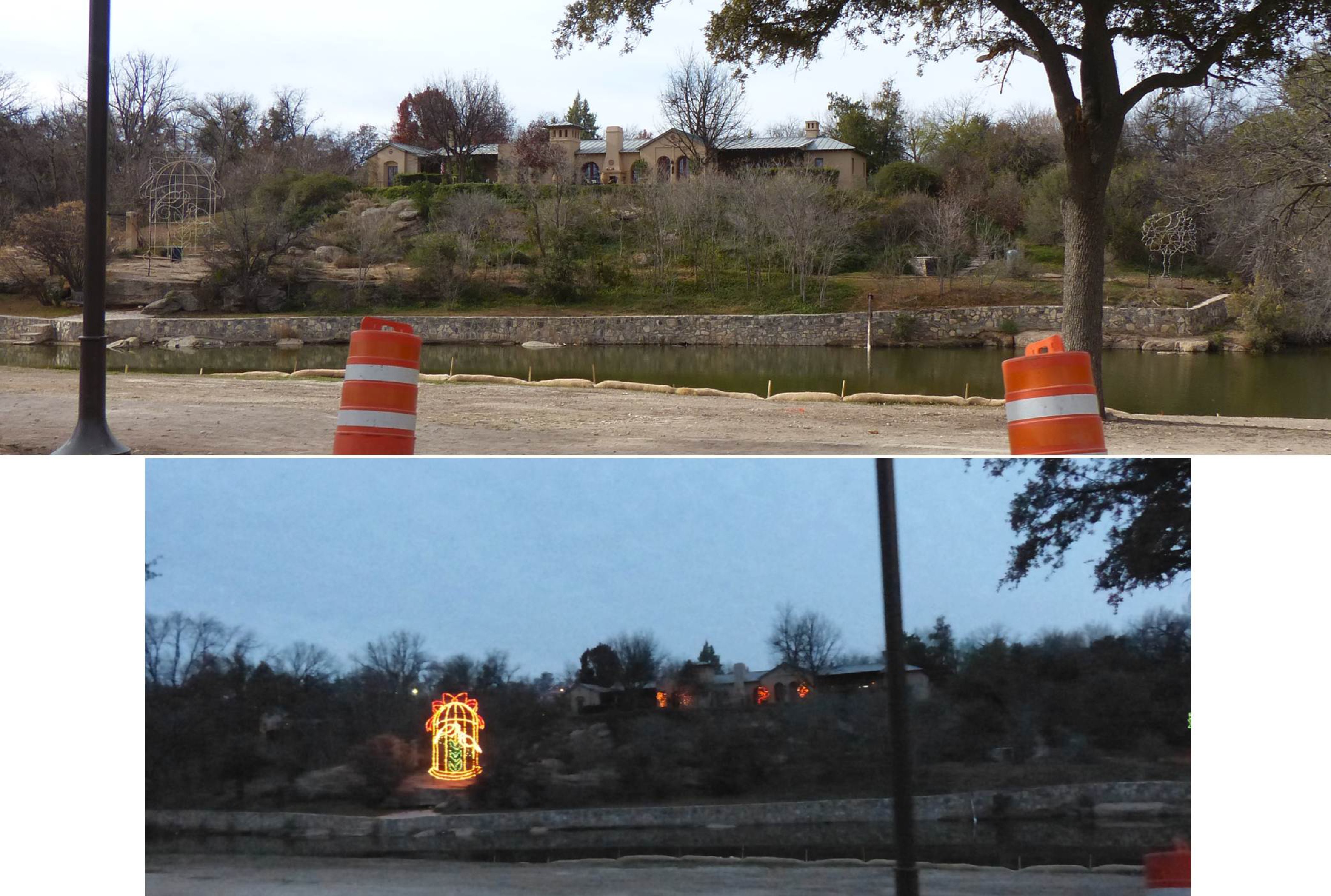
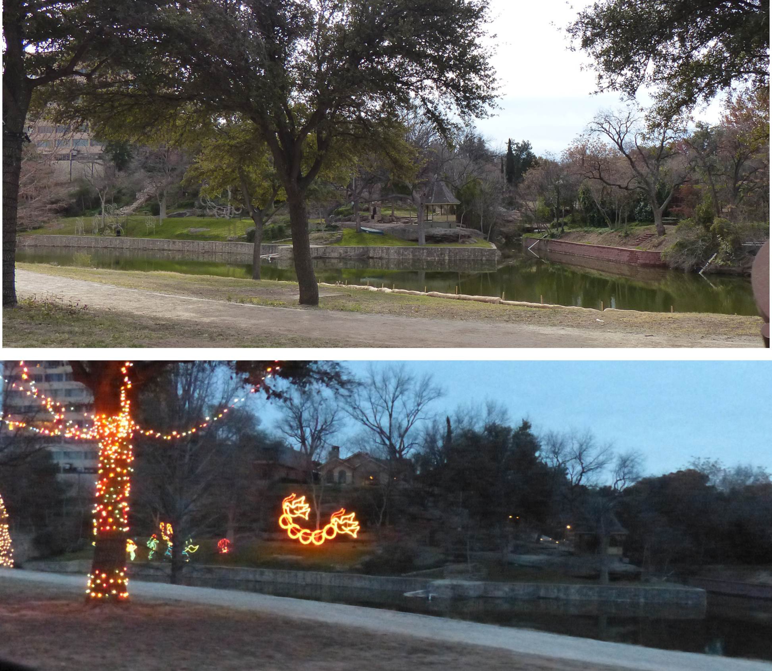
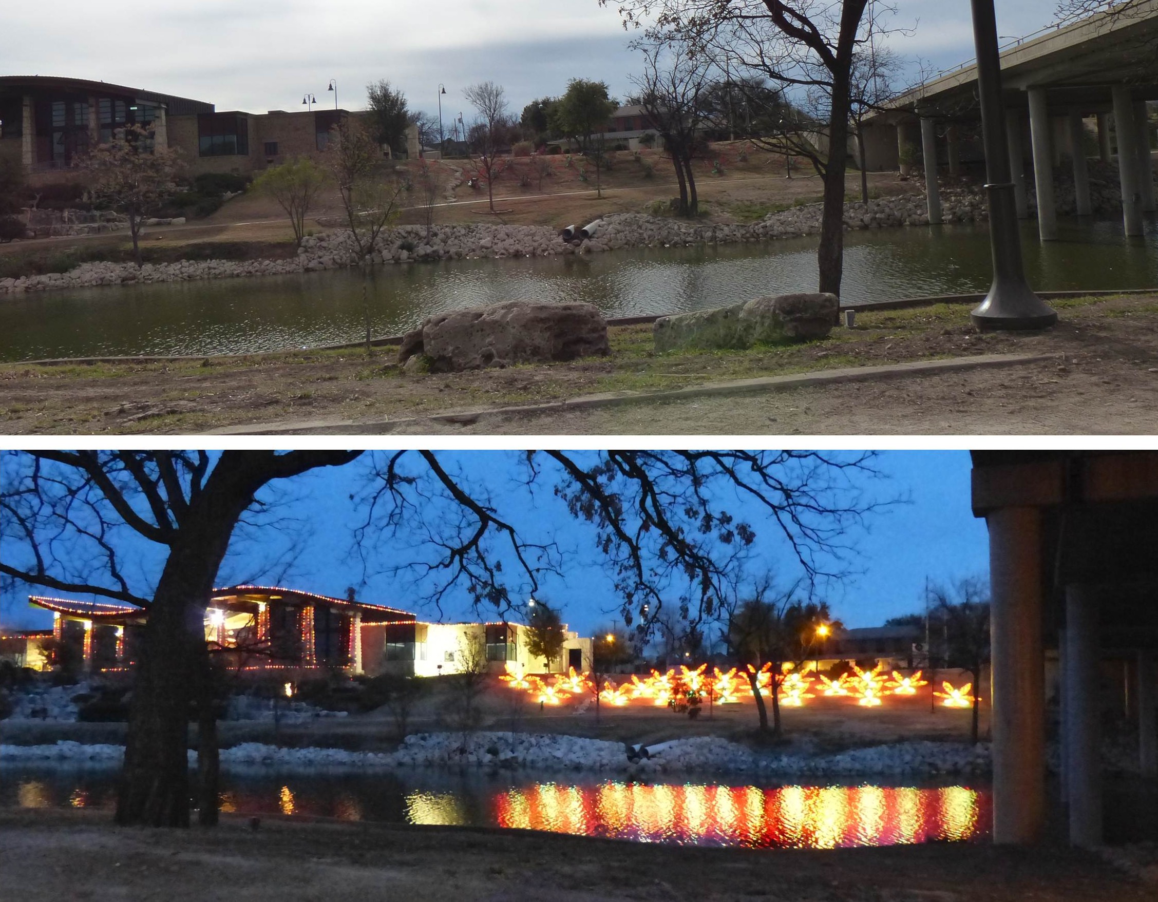
 December 2012 – Took a drive during the day along the river to show off the Concho River view of homes. And then returned during the Christmas Light Decorations Tour.


 2010 – Located close to the San Angelo Train Depot

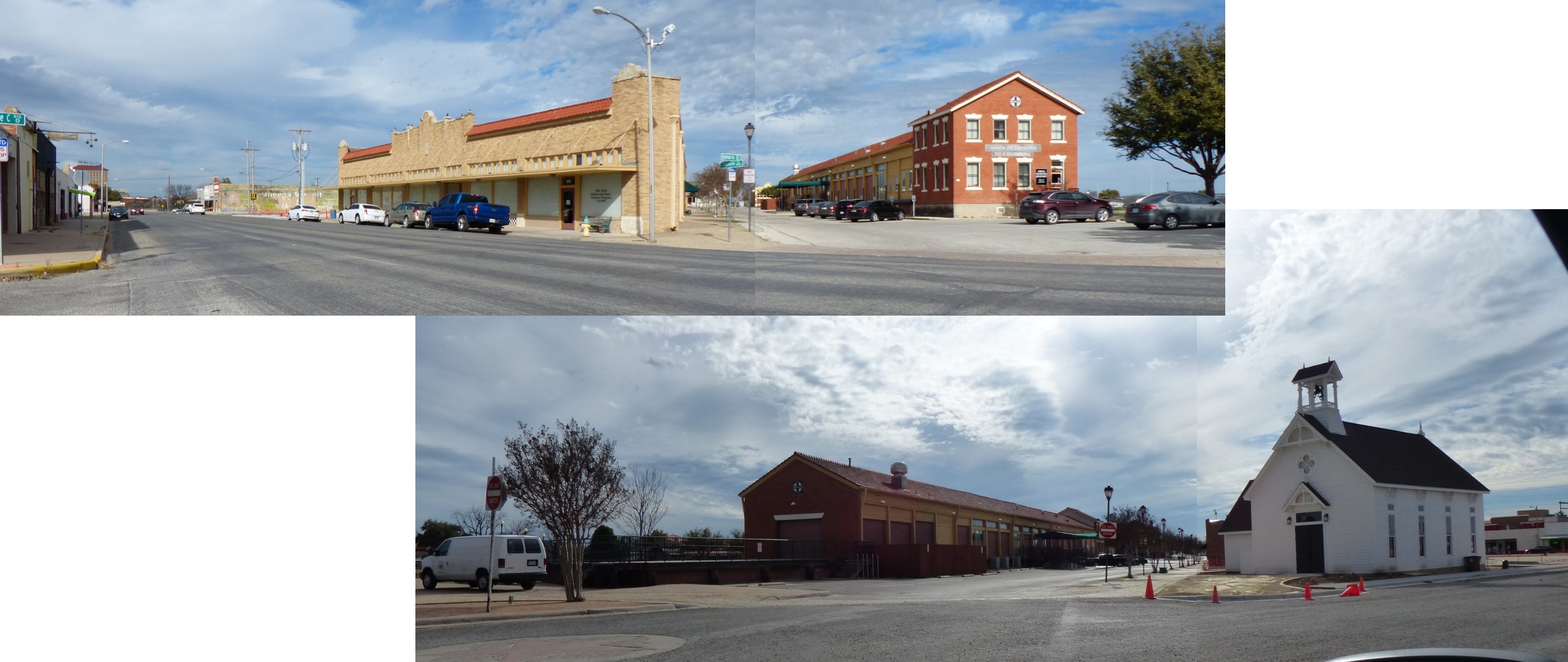 4 February 2019 – Drove by this area and saw a new church added to the Old Town Historic District.

 2011 – Various historical buildings were moved to this “street”.
 2011 – Old Town Historic District
Photograph provided by Google Map data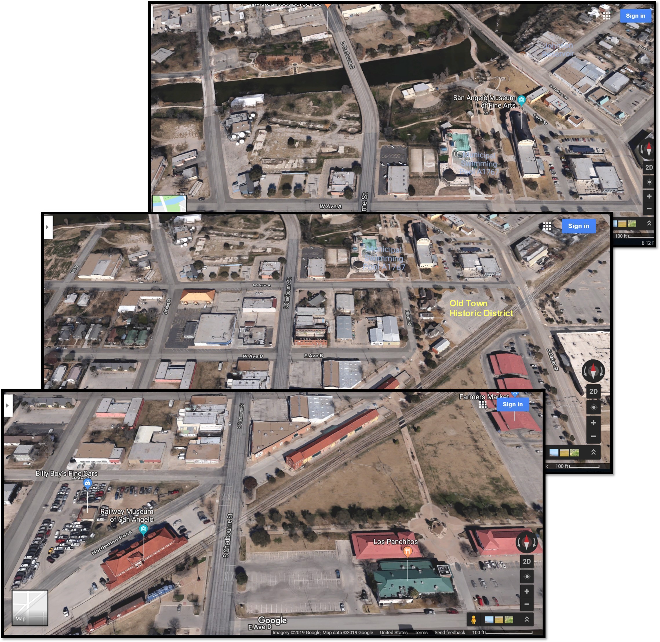 2019 – Aerial of are of city with train station and Old Town Historic District.
 2013 – Looking south, St Paul Presbyterian Church and Peasant Village is off camera to your right. The intersection (by the white building) is S Park and W Beauregard. The metal sculpture (center) has been in this Municipal Rose Garden for as long as I can remember.
 4 February 2019 – Civic League Park metal sculpture
 The sculpture is shown again in top (SOUTHEAST) photo. And St Paul Presbyterian Church is shown in bottom (WEST) photo.
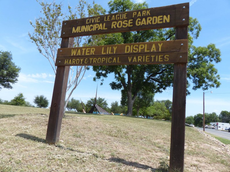
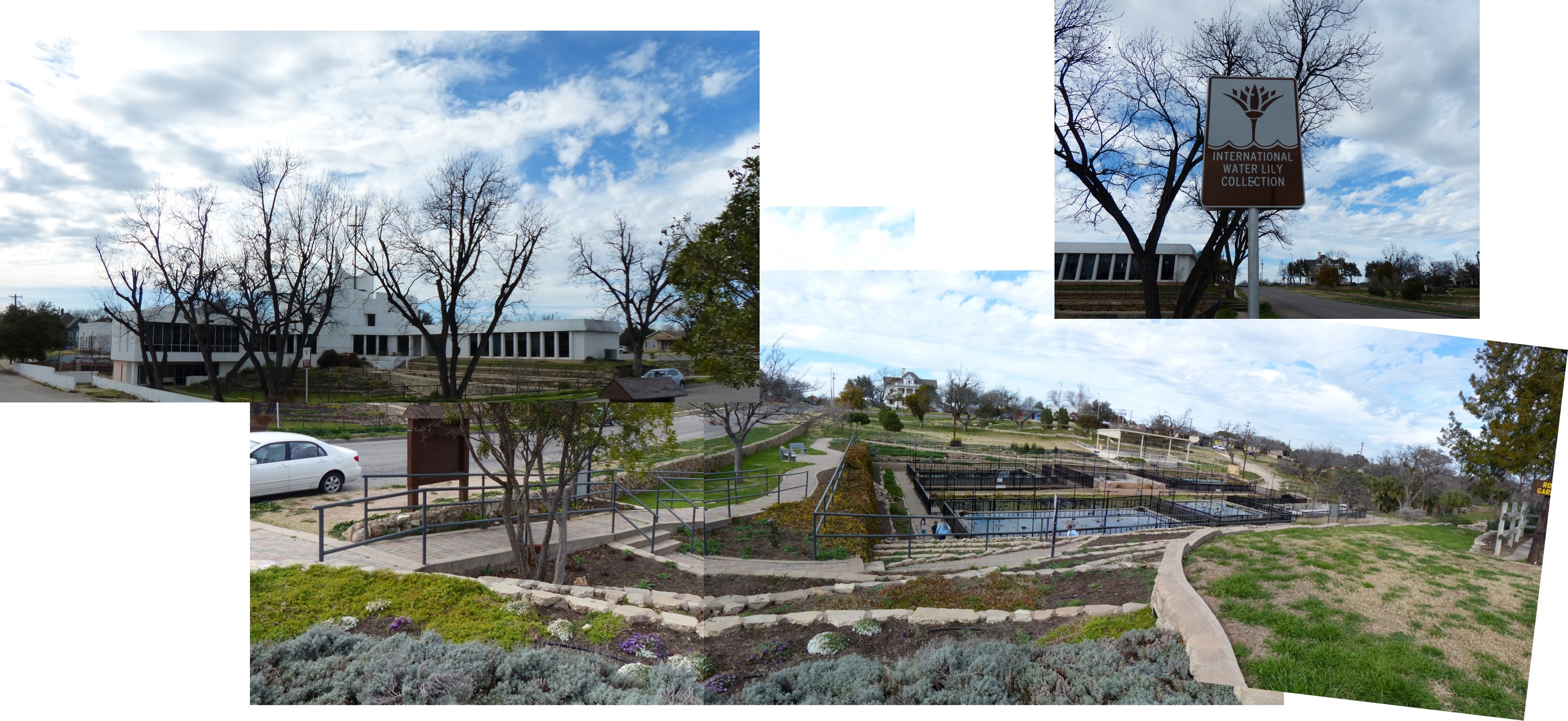 4 February 2019 – Looking north at the Water Lily Display
 4 February 2019 – I “discovered” an outside mural behind St Paul Presbyterian
 4 February 2019 – I “discovered” an outside mural behind St Paul Presbyterian. The Water Lily Display is off camera on the right.

May 2018 – Search on the Internet for the “Lady in Blue”. These two statues were put in place in May 2018.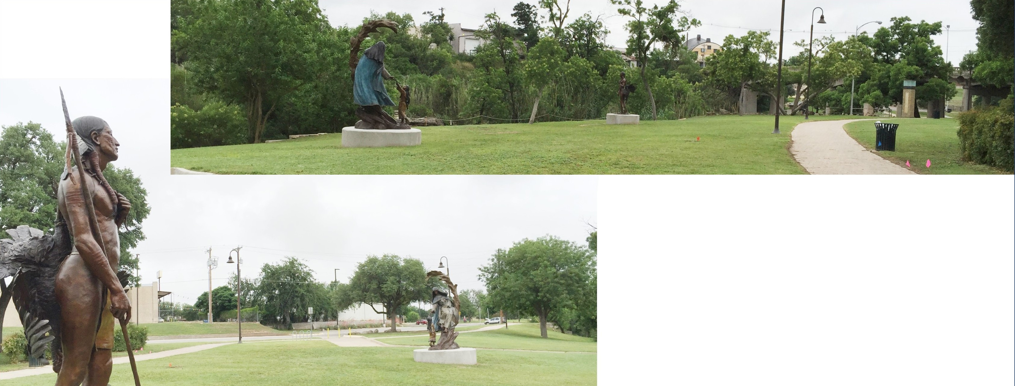


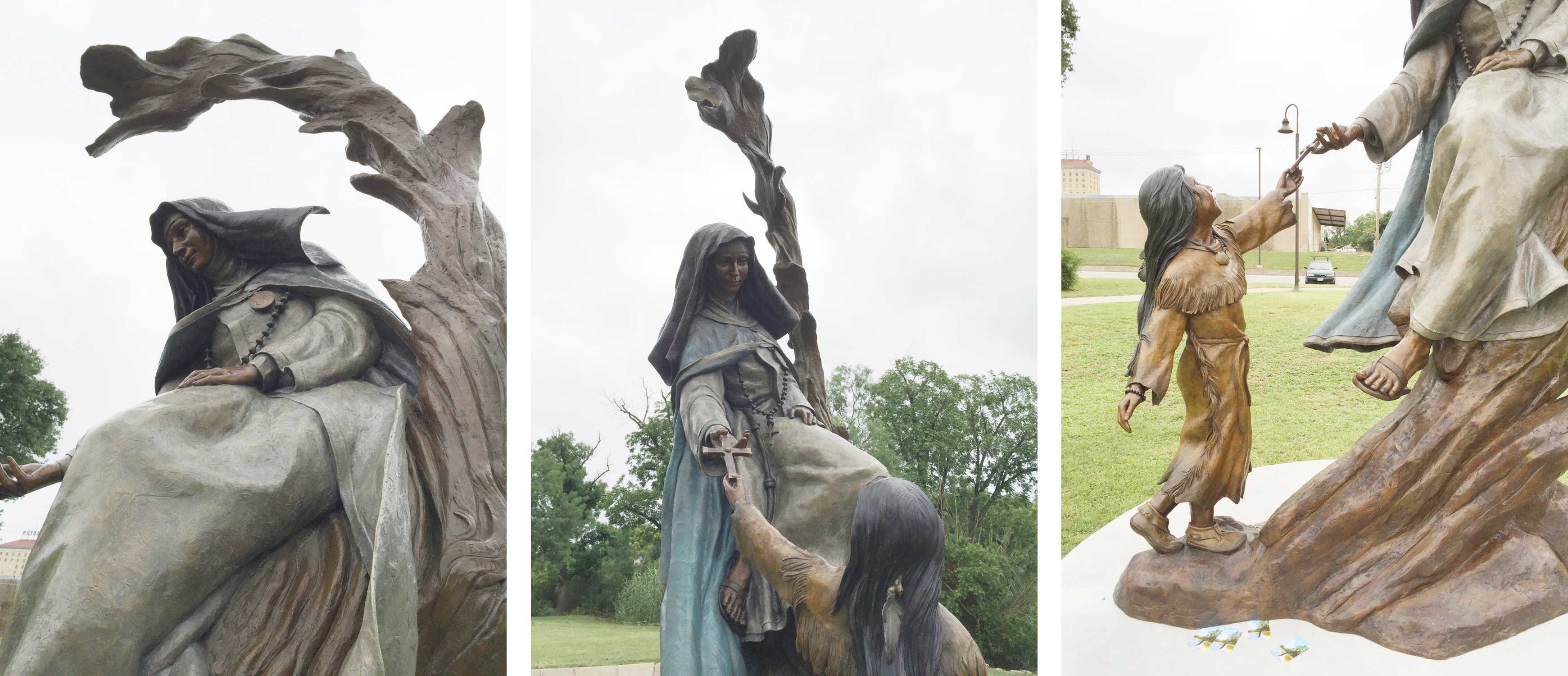
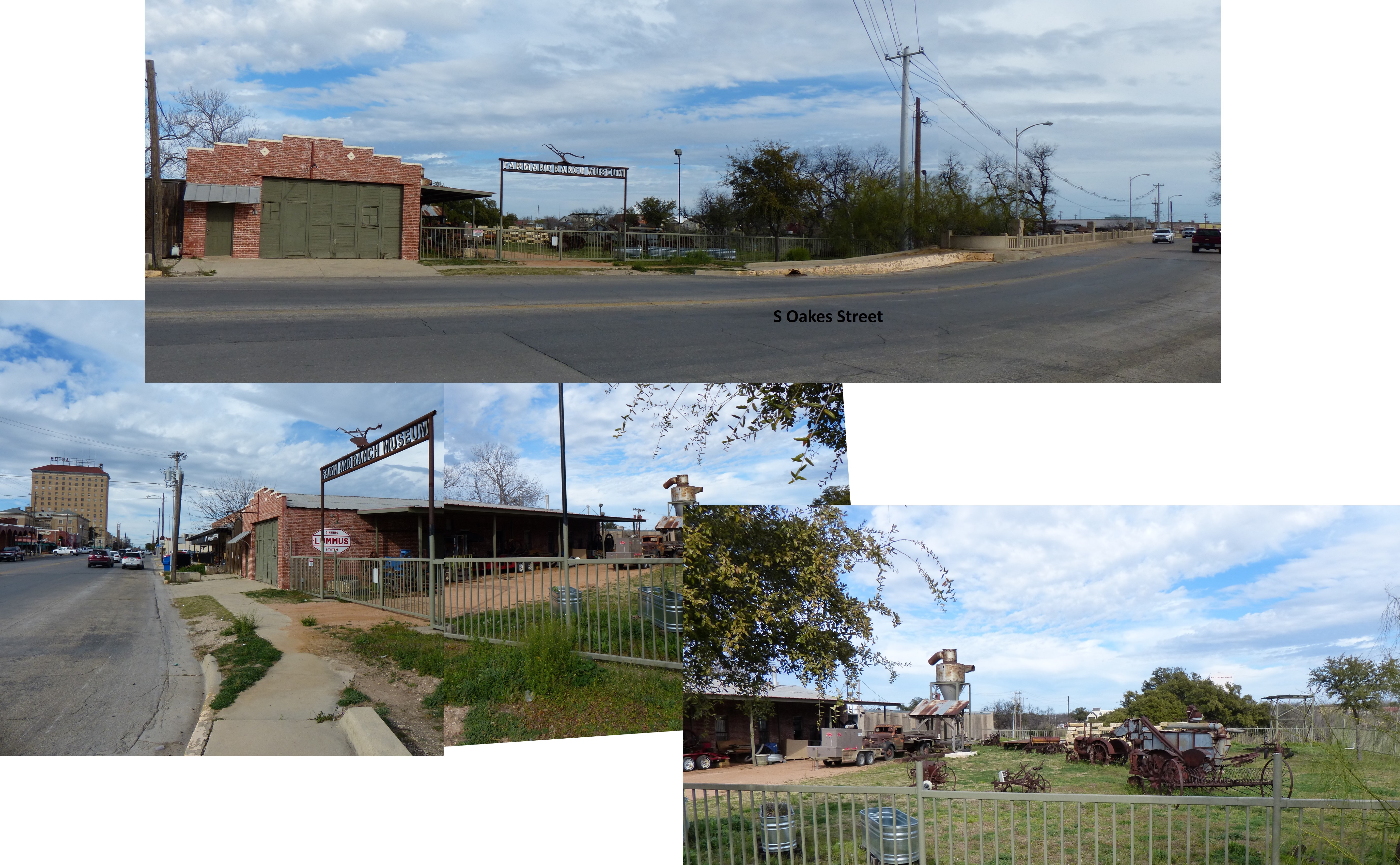
 4 February 2019 – I was standing on the S Oakes Street bridge looking northeast. The Lady in Blue is the statue on the left in the oval; native Indian on the right.) Rio Concho Manor (RCM) is tall building in the background. The Holiday Inn and then Holidome, Clarion Inn & Suites, Quality Inn & Suites, Pearl of the Concho whatever they are calling the place now is seen to the left of RCM behind the tree. Off camera to the left at the end of the bridge is the Farm and Ranch Museum (next photographs).
 4 February 2019
 2011 – The Old Chicken Farm Art Center Center was founded in 1971. Located on Martin Luther King Drive.
For more information, please check out: http://www.chickenfarmartcenter.com
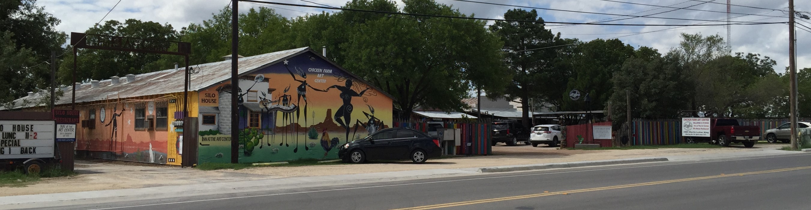 September 2018 – I drove by and noticed the outside had been repainted.
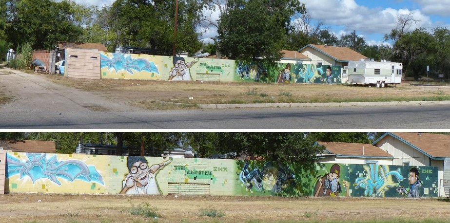 2013 – This artwork is located at the corner of W Ave L and S Irving St
 November 2018 – Drove by and noticed that the above mural has been totally redone.
 2012 – I saw this on right side of a building on Beauregard (and the next photograph will show what is on the other side).
 2012 – I saw this on the left side of a building on Beauregard (and the previous photograph will show what is on the other side).
 2011 – Murals in store front windows on Chadbourne
 2011 – Murals in store front windows on Chadbourne
 2011 – Murals in store front windows on Chadbourne
 2011 – Murals in store front windows on Chadbourne
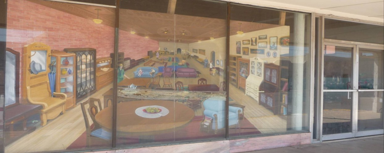 2011 – Murals in store front windows on Chadbourne
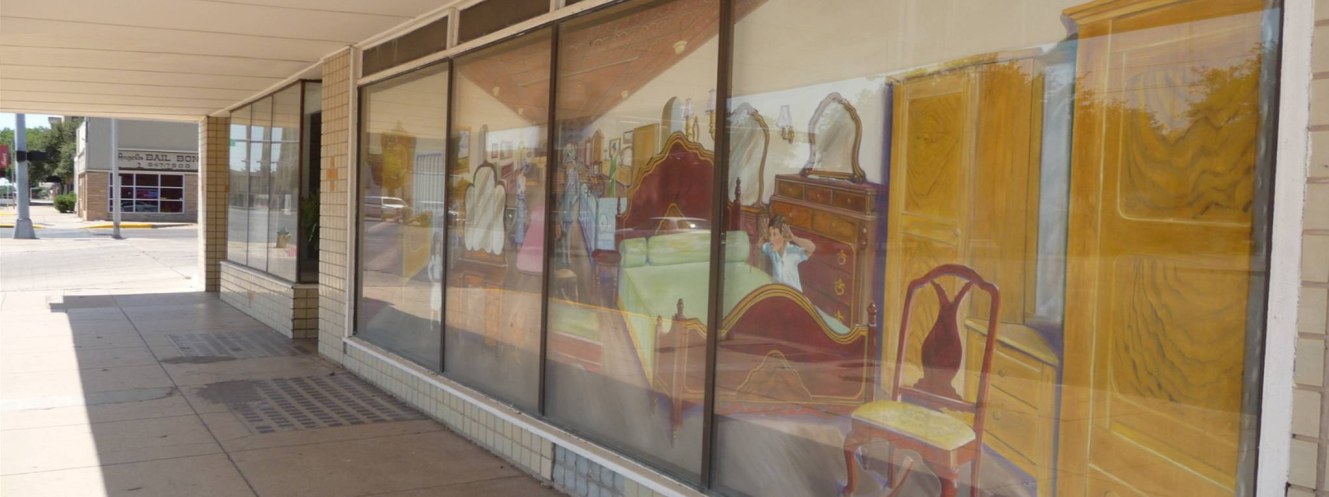 2011 – Murals in store front windows on Chadbourne
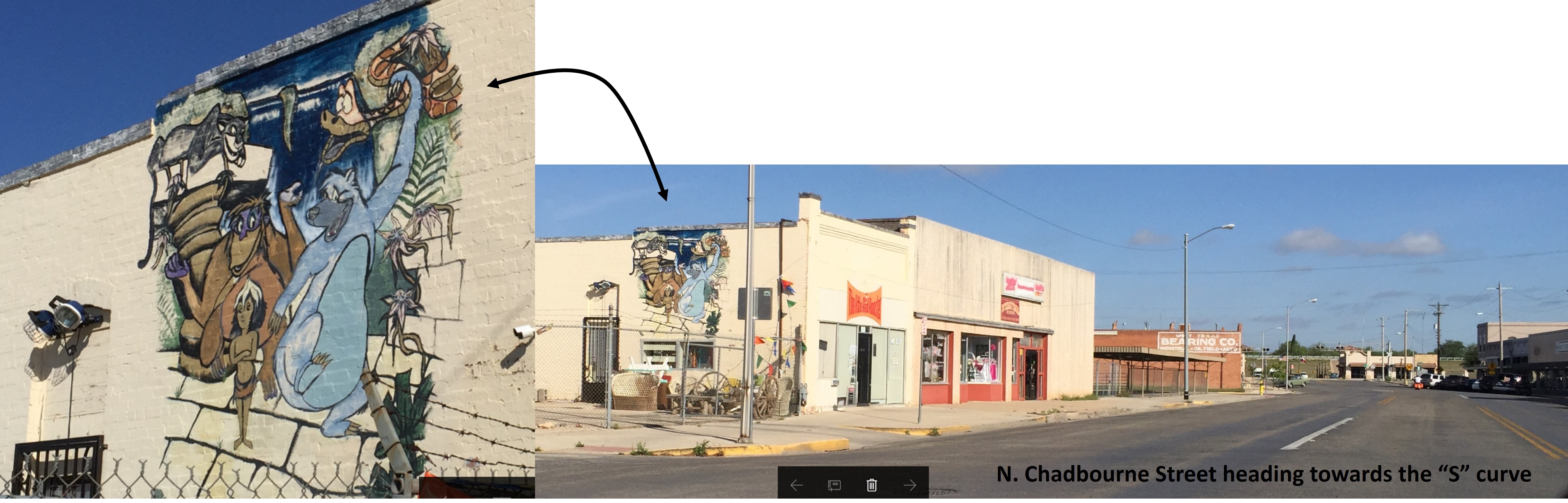

 2011 – Looking north, interesting front door on Chadbourne Street (near the “S” curve).
 2011 – Looking north, interesting front door on Chadbourne Street (near the “S” curve).
 2011 – Looking north, interesting front door on Chadbourne Street (near the “S” curve).
 2012 – Another window mural located by the new Bus Terminal Area.

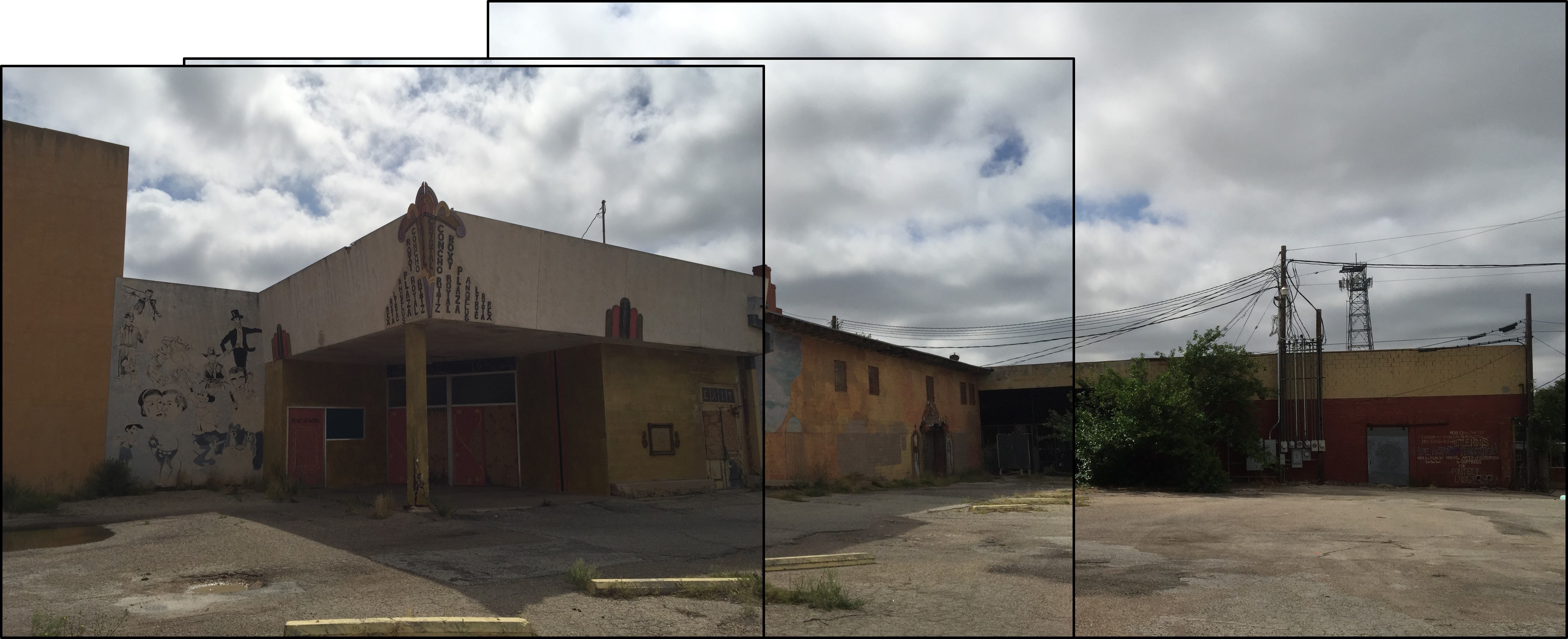
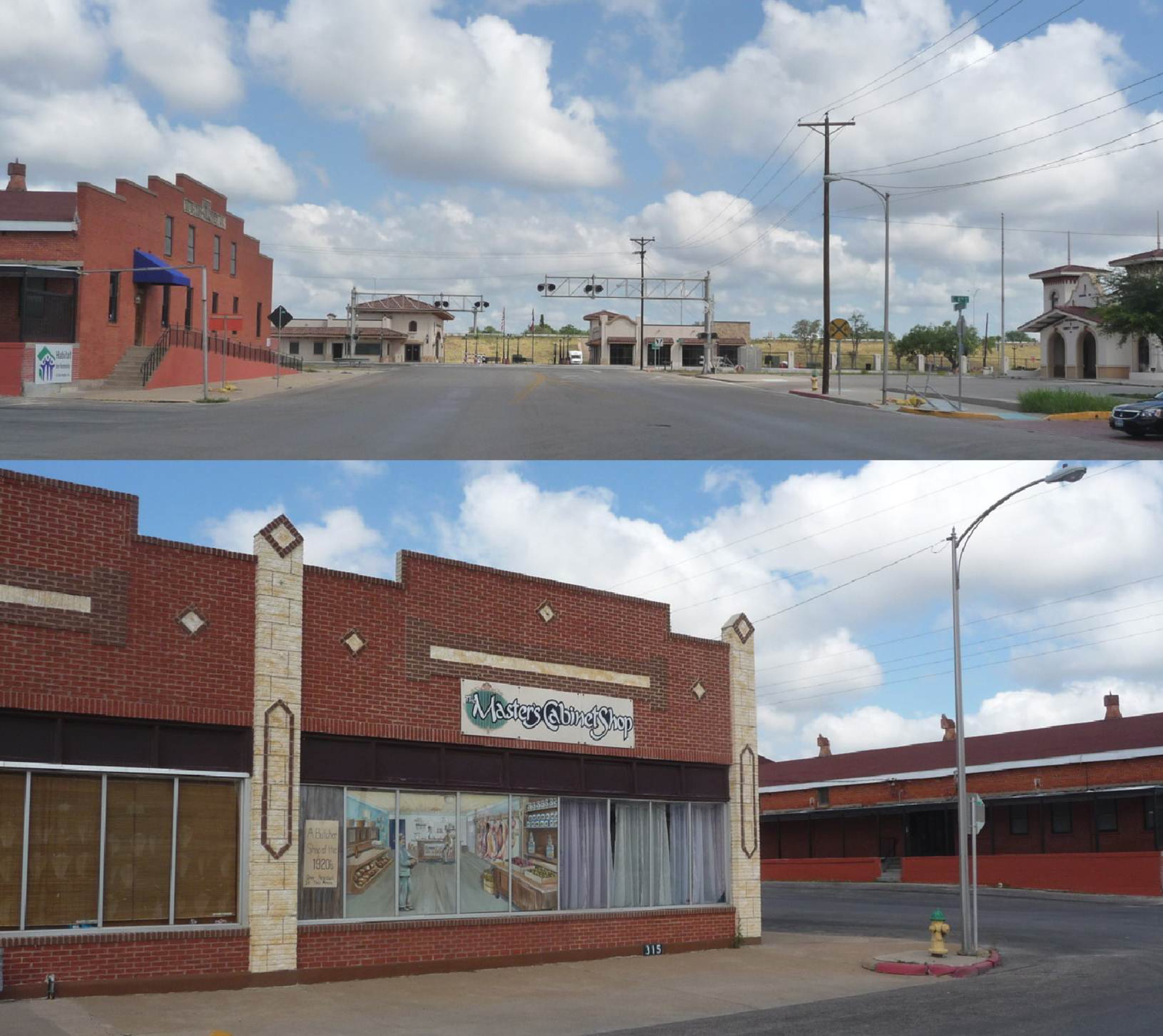
 The 1902 Martin-Clover Co. building is located at the “S” curve where Western Iron Works (now the new Concho Valley Transit District complex) is located.

 The 1902 Martin-Clover Co. building is located at the “S” curve where Western Iron Works (now the new Concho Valley Transit District complex) is located.
 March 2018 – Looking north, at the corner of East 9th and N. Chadbourne is this very impressive painting.
 12 December 2018 – Noticed this mural while on E Concho heading to S Oakes St. Eggemeyer’s General Store is up on the street (on the right).
 2011 – Murals on building at corner of Concho Ave and Oakes St.
 2011 – Murals on building at corner of Concho Ave and Oakes St.
 2011 – Murals on building at corner of Concho Ave and Oakes St.
 2011 – Murals outside a shop at Concho Crossing across the street from Eggemeyer’s General Store.
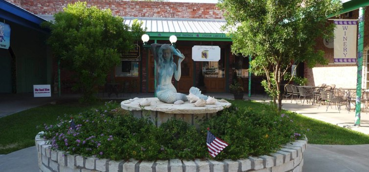 2011 – This mermaid is located close to the murals in previous photograph.
 2012 – A new military-themed mural has been commissioned. It is located at corner of Concho Avenue and Oakes Street.
 2013 – Looking east on Concho Avenue, heading towards the base is a fantastic military mural. See next three photographs.


 2009 (November) – Looking SSE, San Angelo Art Museum (9-11 Memorial is off camera to your left and the River Stage is off camera to your right [behind you]). If you walk up the stairs, you will see the statues that are in the next two photos.
 2009 (November) – Statue positioned at the top of the stairs, under the large windmill, next to the Art Museum.

 2009 (November) – Looking NE (towards the river), the tan building is the Art Musuem, and the windmill (with the statue of two cowboys) is off camera to your right.
 2009 (November) – 9-11 Memorial by the River Stage and Art Museum
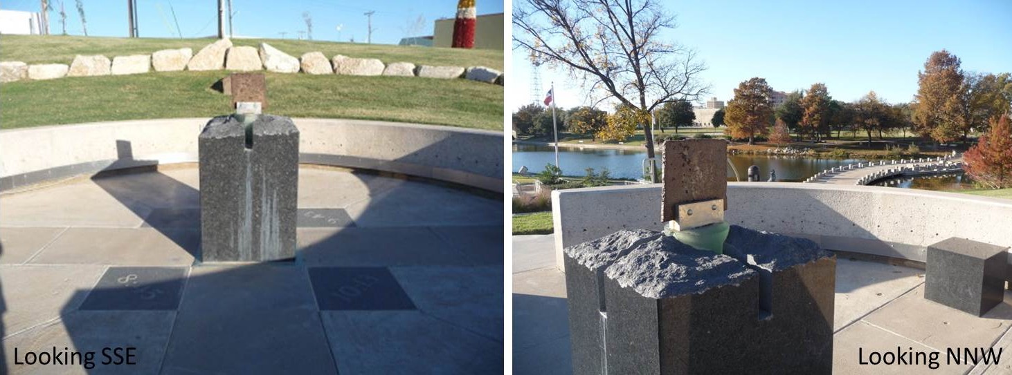 2009 (November) – 9-11 Memorial by the River Stage and Art Museum
 2009 (November) – 9-11 Memorial by the River Stage and Art Museum
 18 September 2018 – Finally thought to return to get a clearer picture. (Sorry, only took me almost 9 years to remember to do it.)

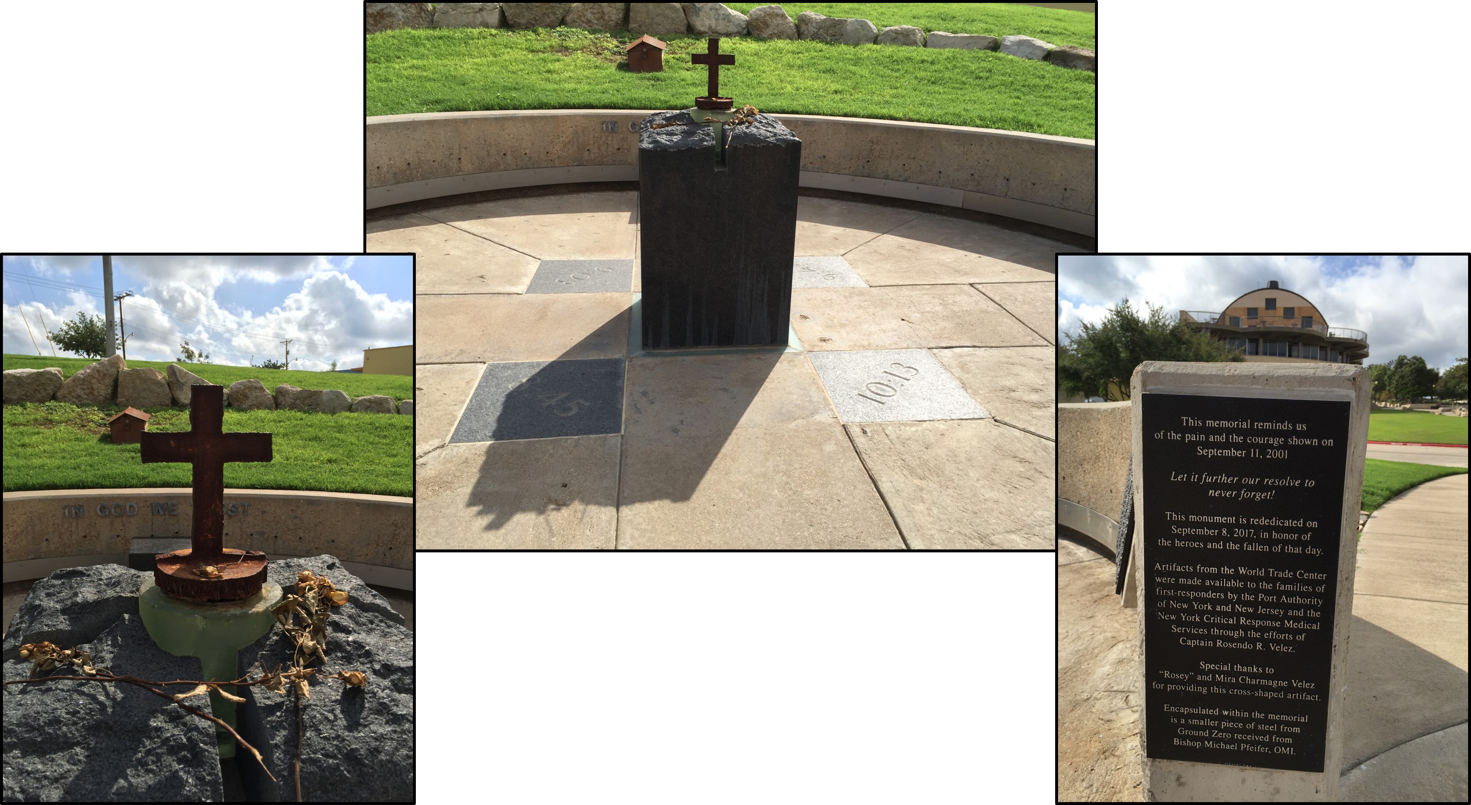 September 2018 – I returned to take additional photographs because in June 2016 vandal(s) stole the piece of steel that came from the World Trade Center. A metal cross replaced the stolen steel.
Bottom Photograph provided by Google Map data 2009 (November) – Hotel Cactus, Celebration Bridge, and 9-11 Memorial (the River Stage is off camera, behind you). 2011 (October) – View of Concho River drained from my camera and from GoogleMaps.
 2009 (November) – Celebration Bridge and Pearl of the Concho Mermaid (River Stage is off camera to your left and 9-11 Memorial is off camera behind you to the right).

 2013 – Municipal Swimming Pool had a major facelift.
 September 2013 – Located at the corner of S Abe (Bryant Blvd) and W Washington Drive
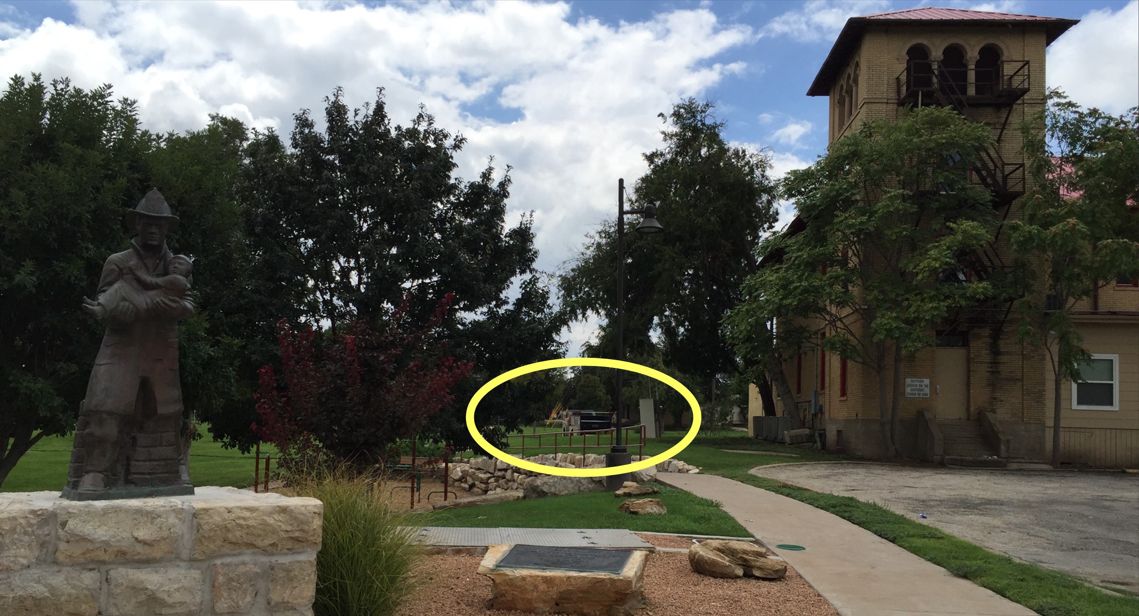
 7 September 2018 – I never realized that there was a statue of a fireman with child behind the old central firehouse (which is going to be turned into a Bed and Brew place) by the City Park on corner of S Magdalen Street and Rio Concho Drive.
 7 September 2018 – The other day we were driving by and I noticed a fire truck decorated. Today I stopped and checked it out.

 2011 – Mural of blacksmith is located on Oakes Street. The next photographs are found off camera to the right and further down in the alley behind the Federal Building.
 2012 – The Blacksmith mural is by the utility pole in above photograph.
The white, three-story building (seen on the right) is the back of the Federal Building Courthouse.
 2012 – These door-size painting hang in the alley behind the Federal Building.
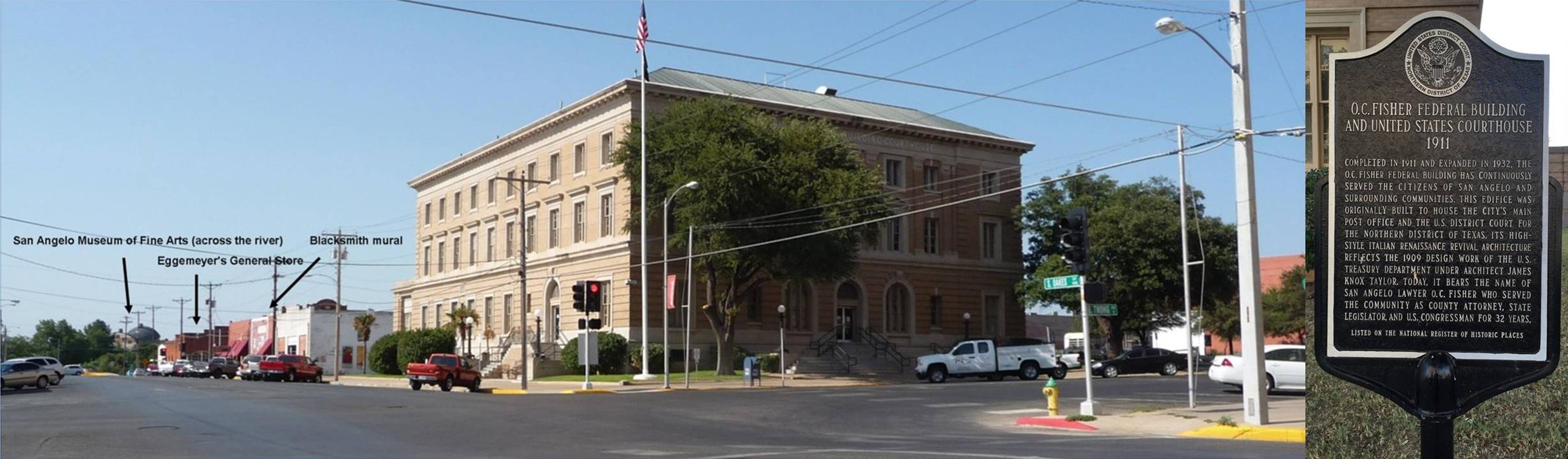 2011 – Now this is that Federal Building Courthouse. This building used to the US Post Office.
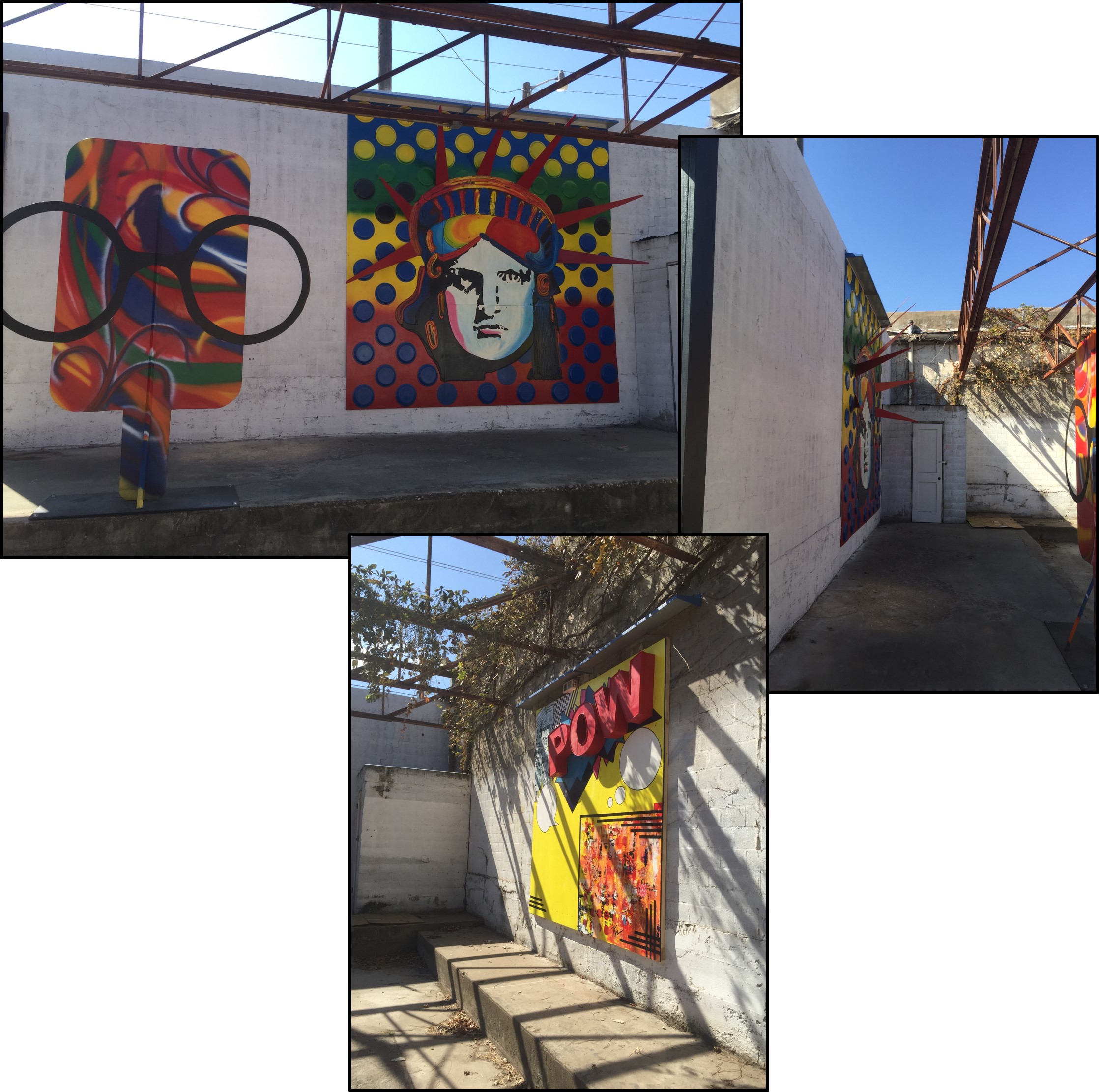
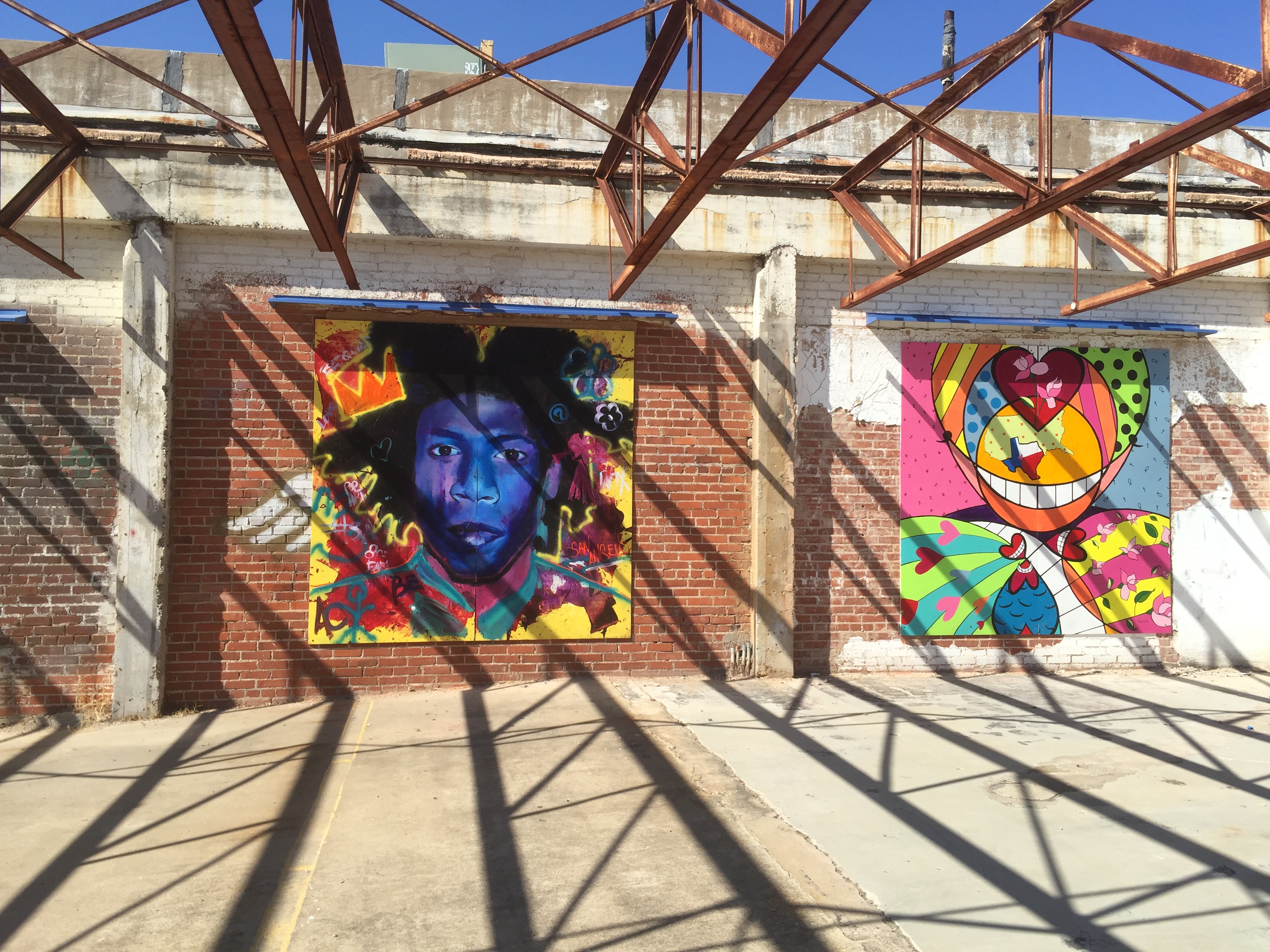
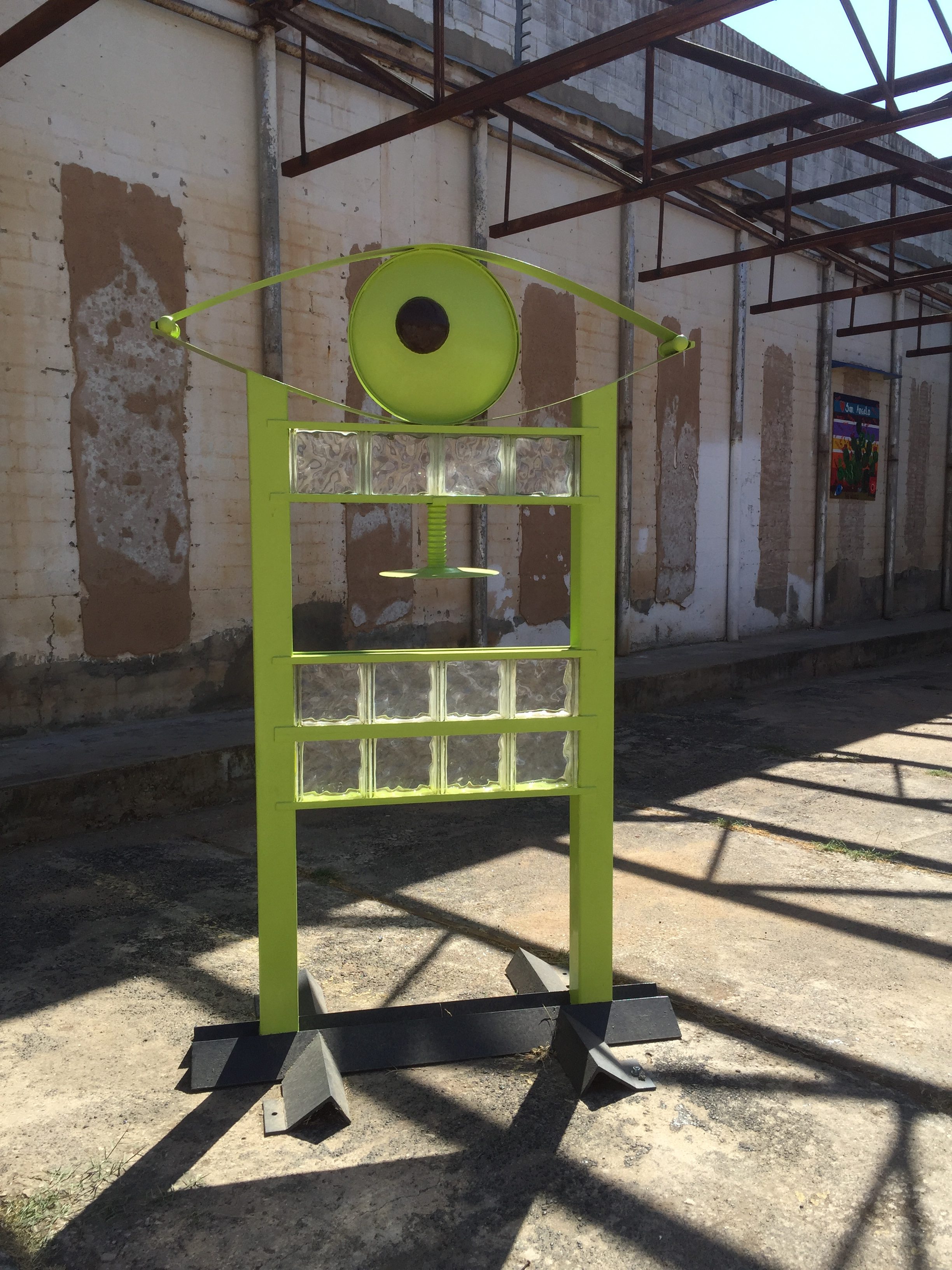
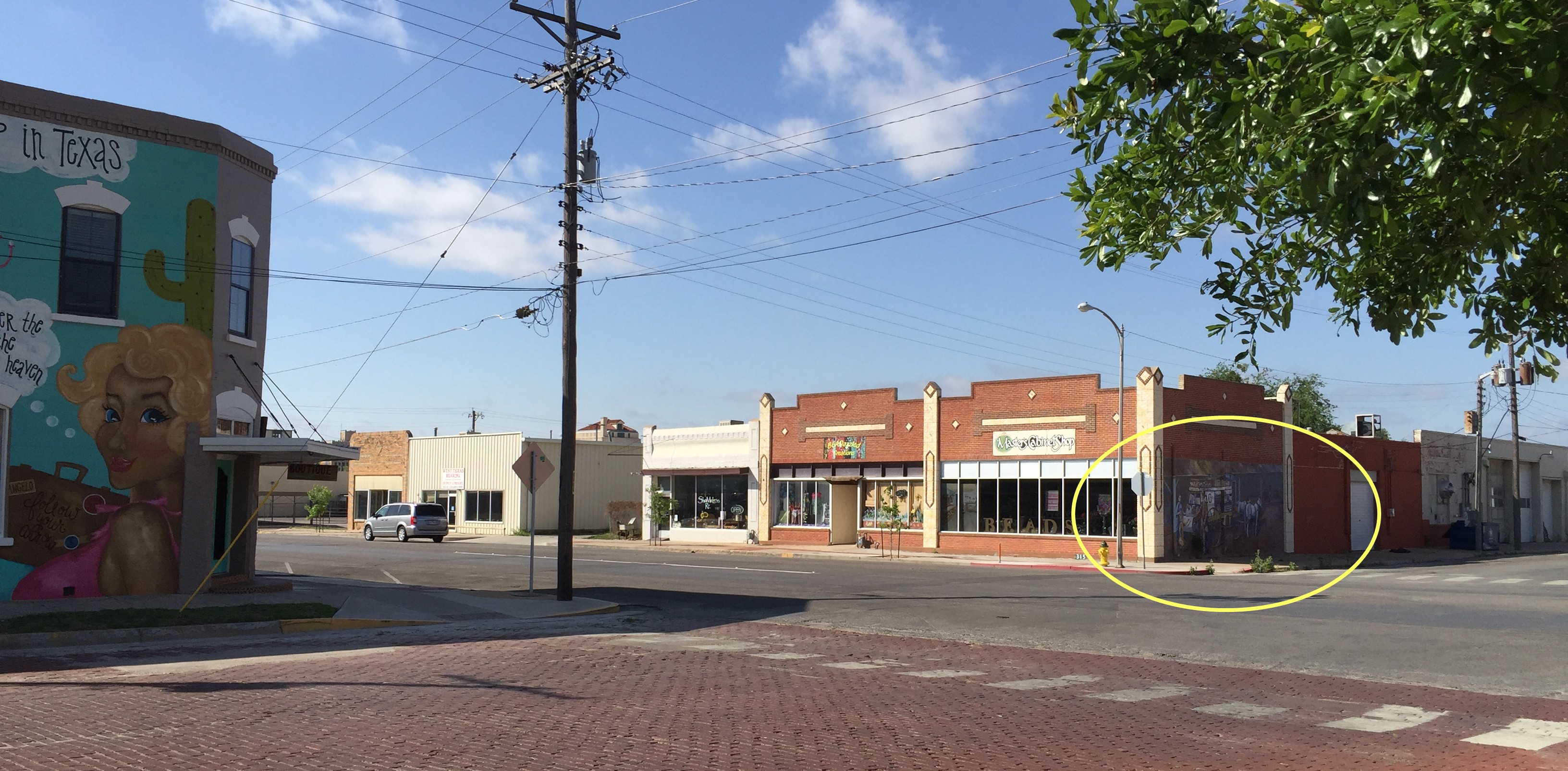
3 October 0219 – Driving by the new Art in Unusual Places Pop Art Museum.

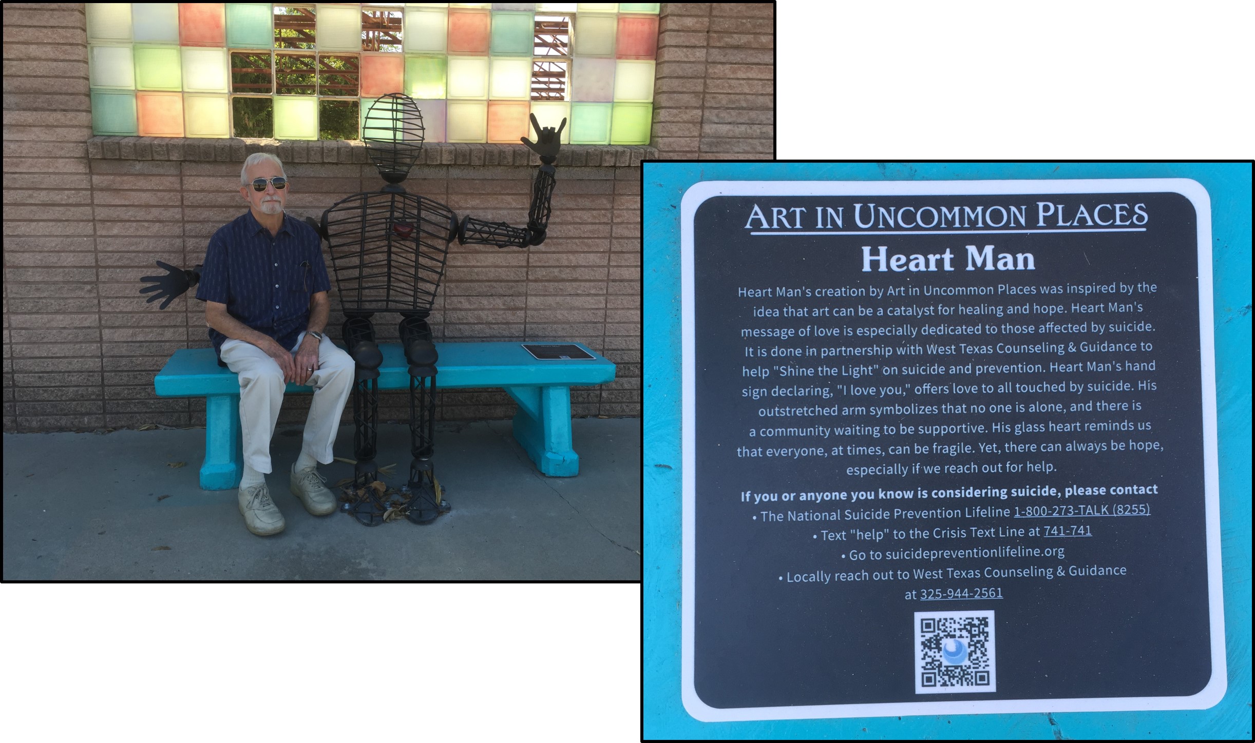

 There are plenty of panels available to paint on both sides of the museum. Not sure if the tire track was supposed to be part of the art.


 2011 – Mural on corner of north Chadbourne Next photograph will show where this photograph can be seen.
 2018 – Burlap & Paisley Salon & Boutique opened in 2016 (I think).

 2011 – J. L. Mercer & Son Boot-making store located downtown.
 December 2013 – Not sure how long this wooden sculpture has been on display. The new Stephens Central Library is at the right (glass windowed).


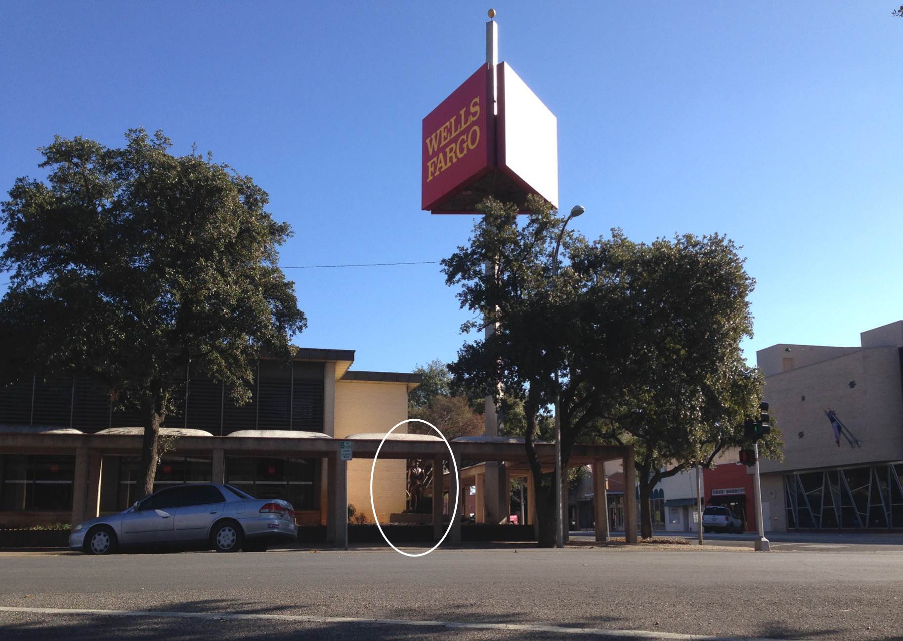
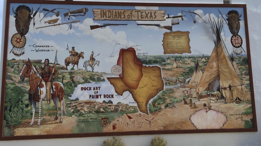
Photograph provided by Google Map data In 2012, this is the building (in oval) that now has the historical mural of Texas Indians.
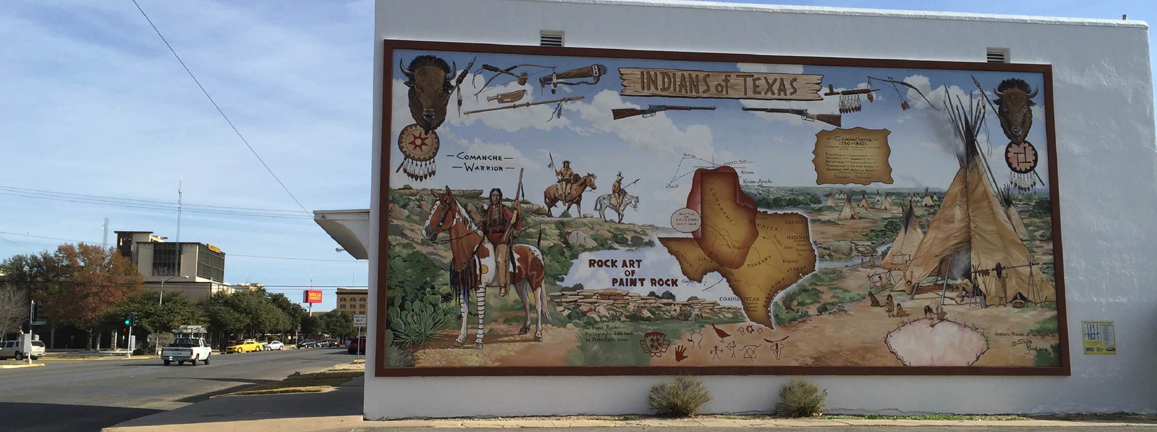 2014 – Another historic mural
 2011 – Mural located downtown
 2011 – Closer look at impressive mural
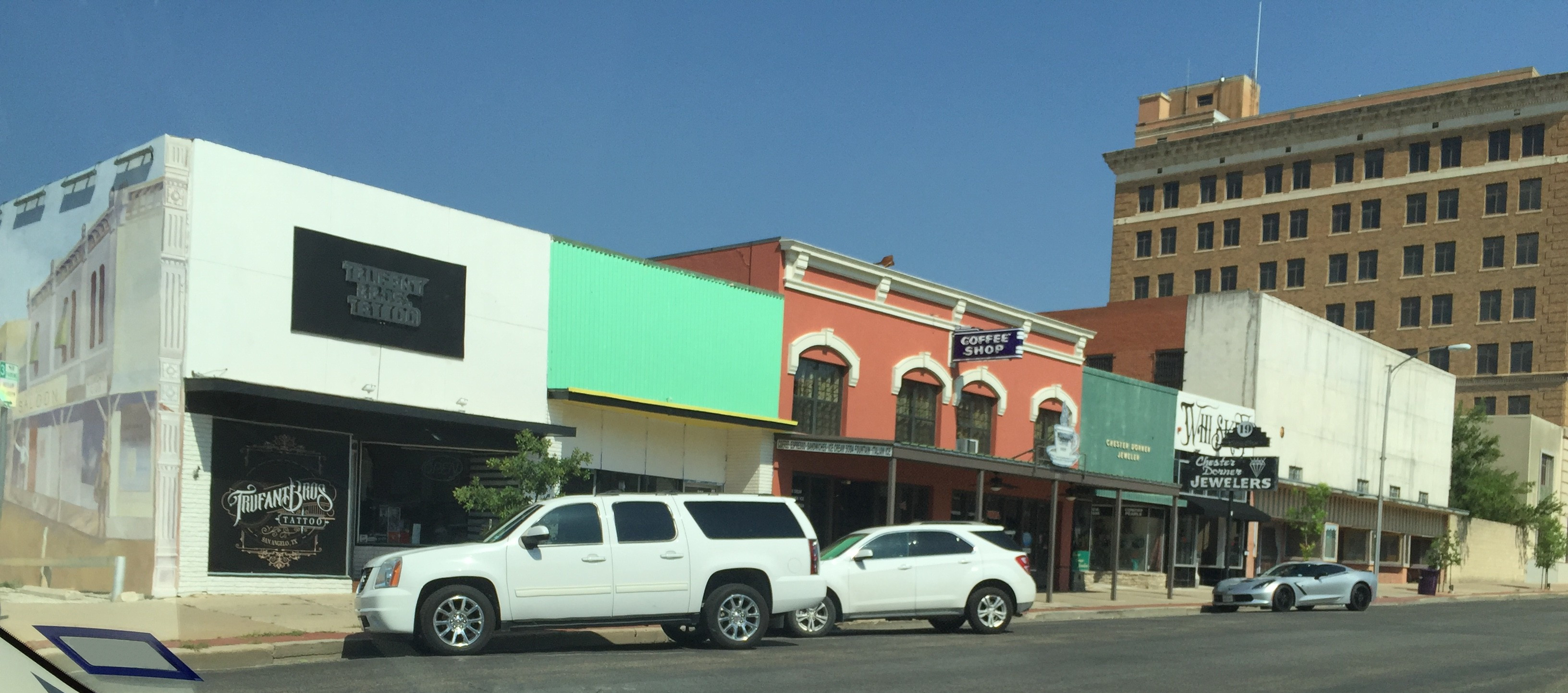 24 June 2018 – Stango’s Coffee Shop (notice the above mural can be seen on the far left).

 24 June 2018 – When you walk into the place you see this view. The next photograph was talked standing by the FEDERAL TIRES sign by the staircase looking towards the street.
 24 June 2018 – Stango’s on Chadbourne Street
 2011 – Elmer Kelton Mural (on one of the Three Sisters) on Chadbourne.
http://www.downtownsanangelo.com/index.html http://www.historicmuralsofsanangelo.org/murals.html
This building use to be Army Surplus. Now it is The Angry Cactus.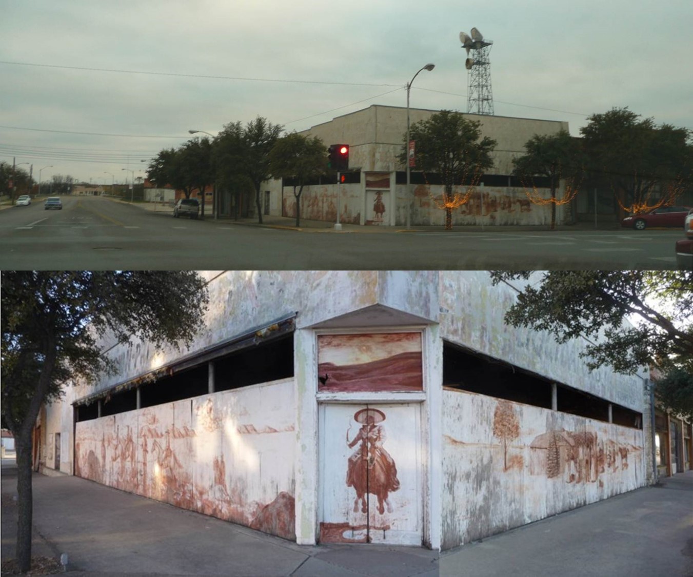

 25 November 2012 – This mural is located next to the Twisted Root Burger Company (behind you off camera).
Photograph provided by Google Map data Twisted Root Burger Company is off camera on the left.
 2012 – Sunset Mall Mural
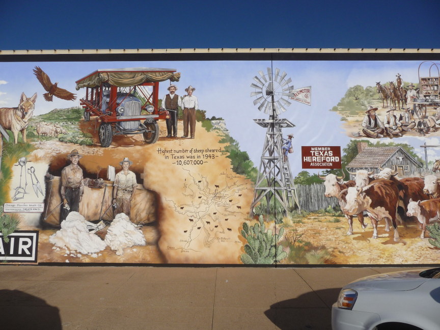
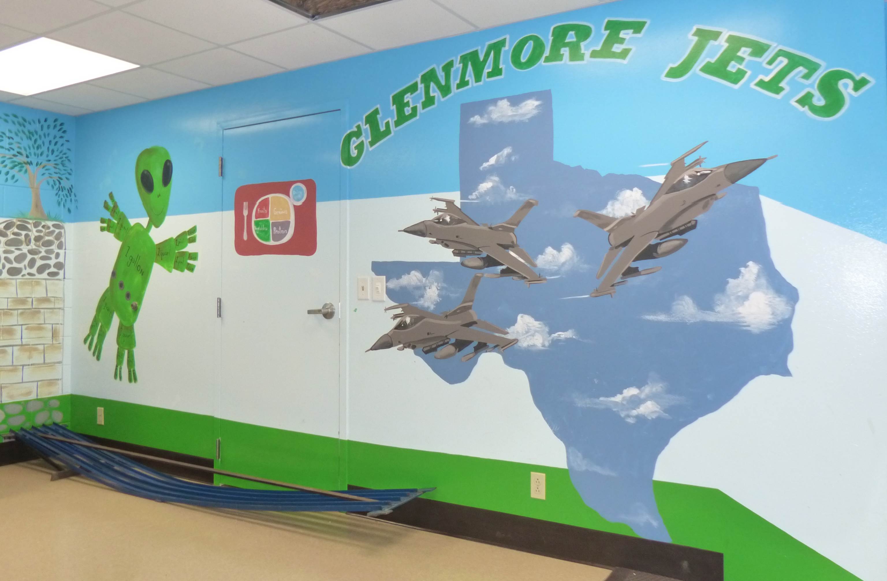
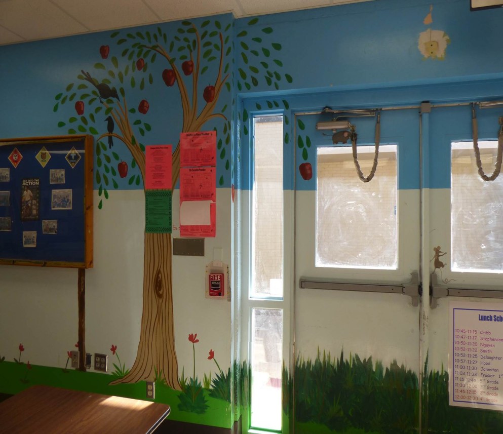
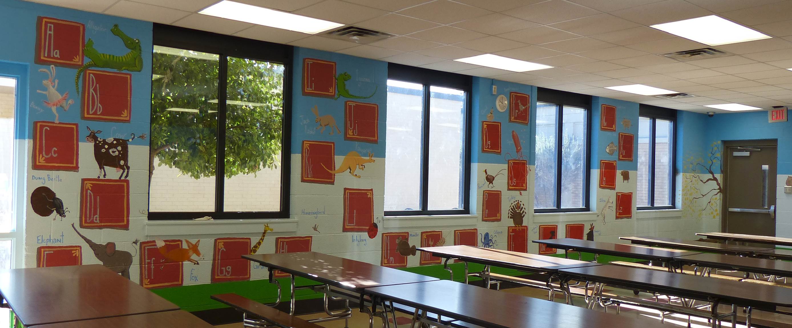
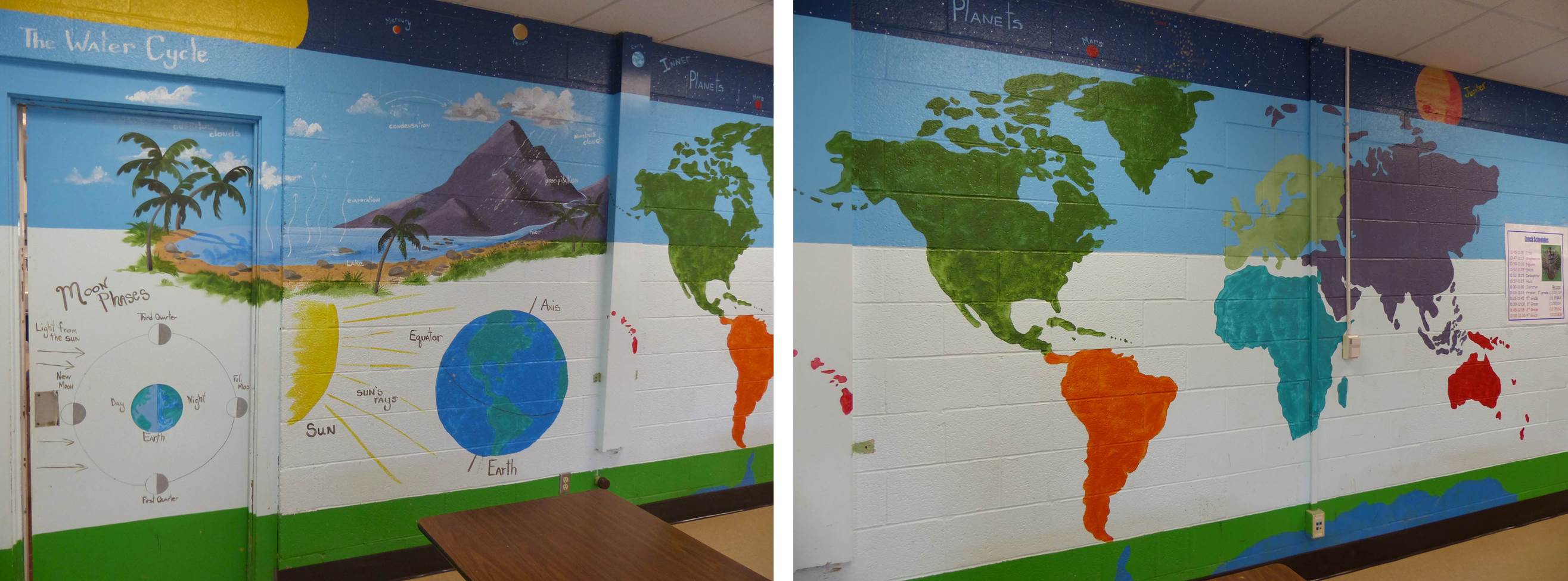
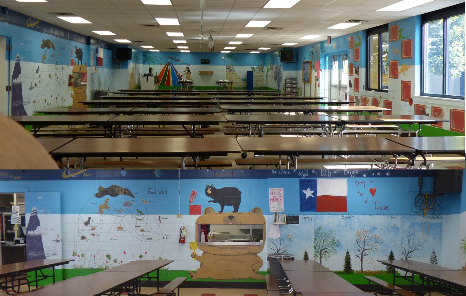
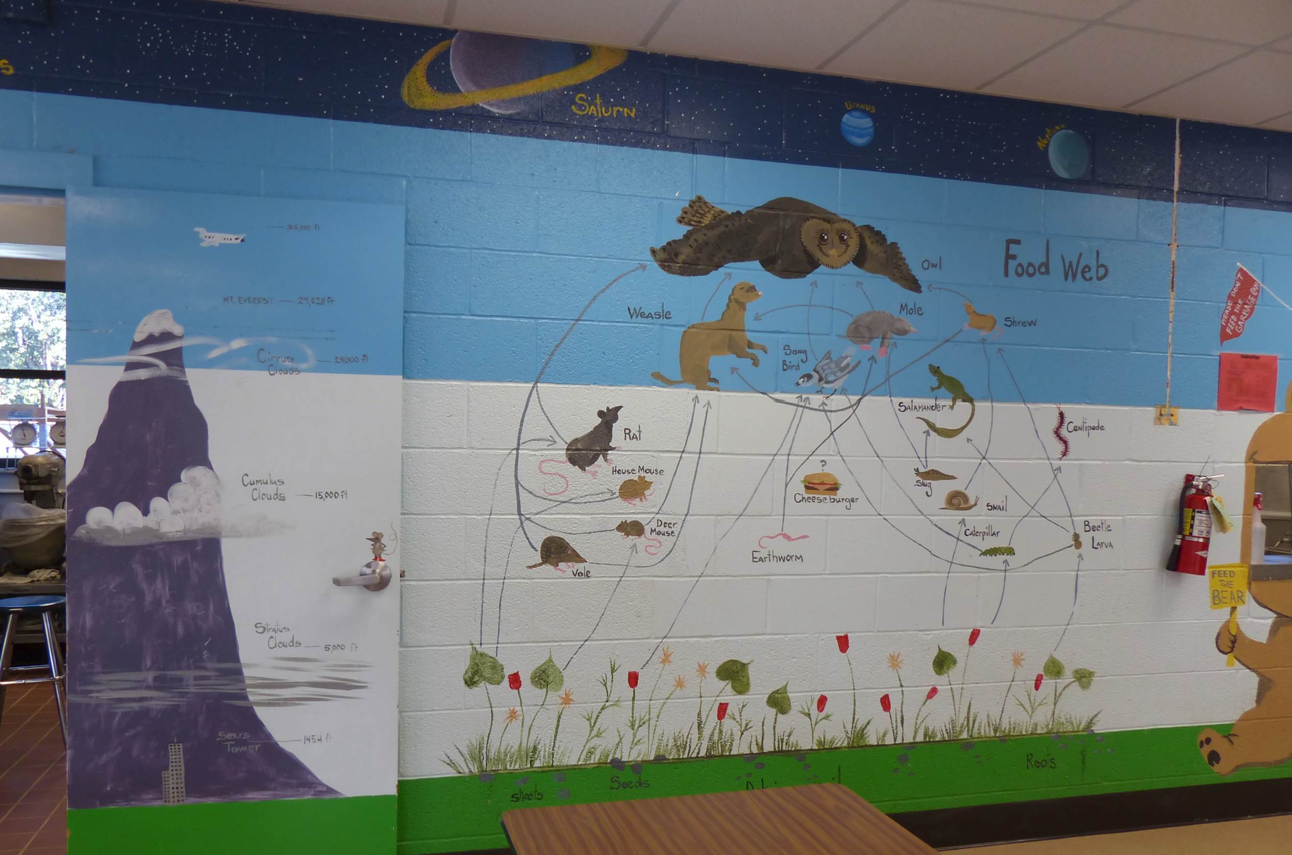
 September 2013 – I heard that Sharon Graham Smith not only painted various sheep around town, she painted a fantastic educational mural found at Glenmore Elementary (which, if you recall, is located near the old north gate). The old north gate would be to the left (off camera).


 November 2012 – Looking east on Sherwood Way is Inkland Tattoo Studio with mural. Next photograph was taken two years later.
 May 2014 – The mural has been removed, only the name of the shop remains.
January 2014 – The Bosque on the Concho. Please check out: http://sanangelolive.com/news/2013-09-19/concho-river-project-nearing-completion


August 2013 – Looking north on Bryant Blvd (but Abe Street is heading south).


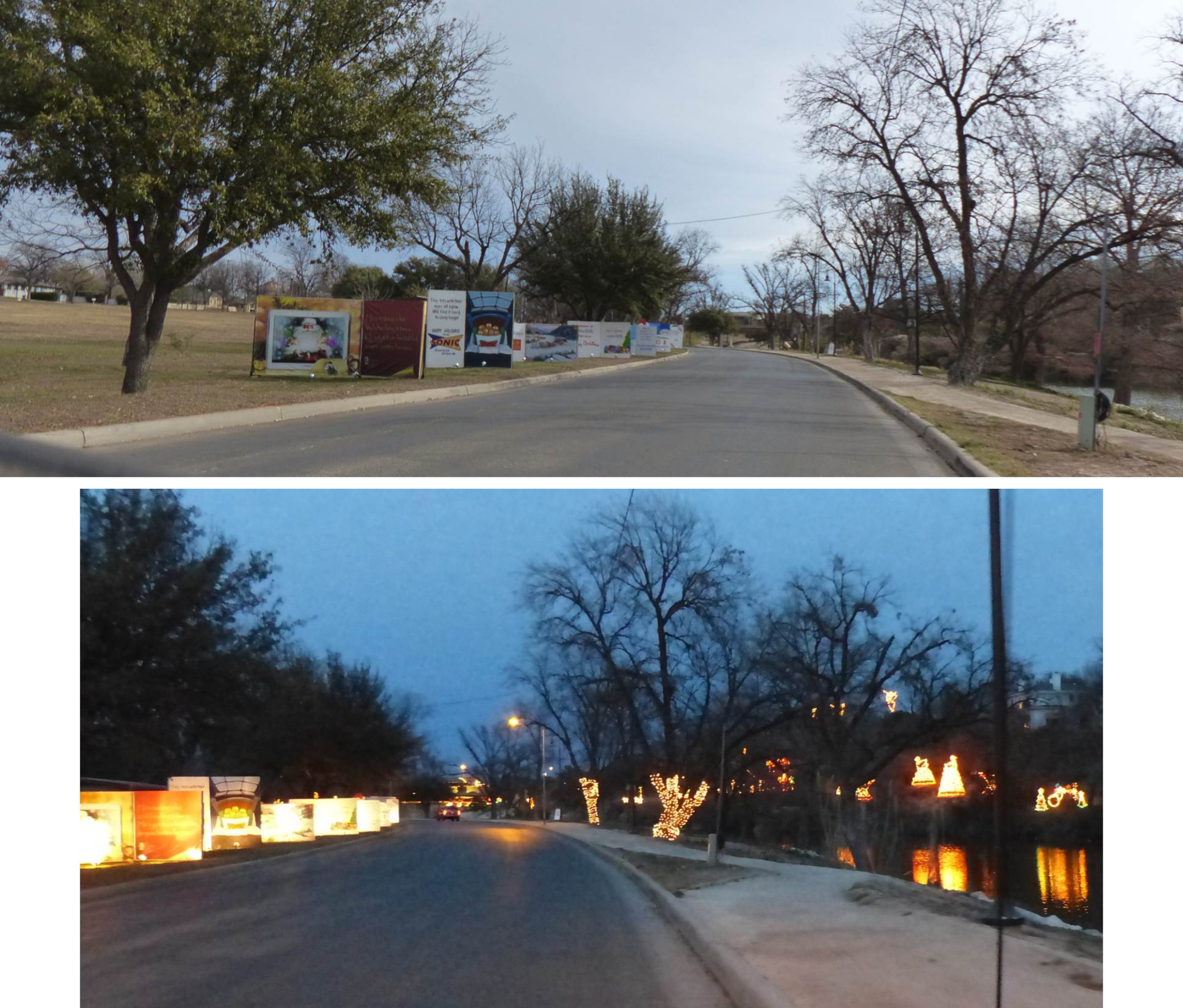
2013 – Photographs below – Driving south on Bryant Blvd (HW87) you pass the Sunken Garden Park on your right. This area is also known as Abe Street Park or Spanish Park.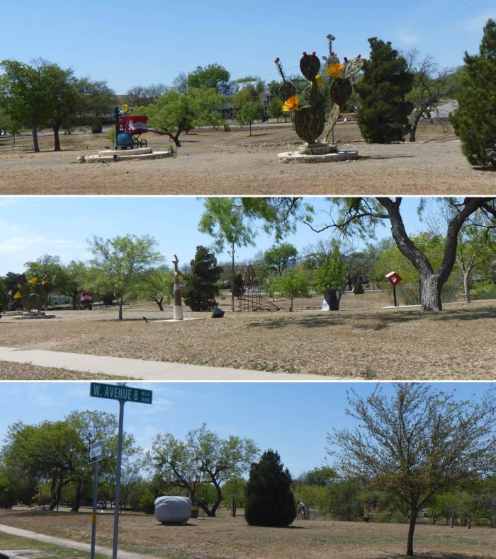
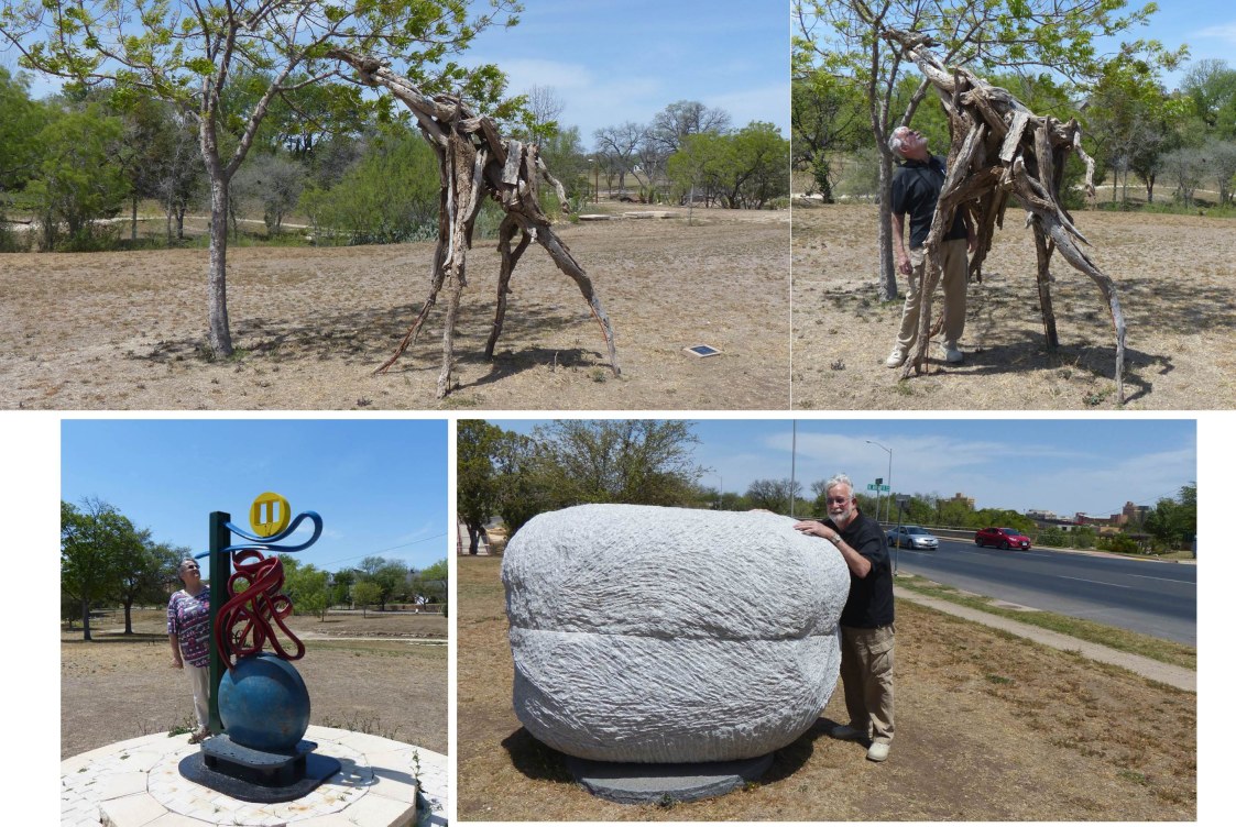 Anthony Fuentez (San Angelo, TX) created Gracil. George Tobolowsky (Dallas, TX) created Dropping In. Jesus Moroles (Rockport, TX) created Grey Cloud.
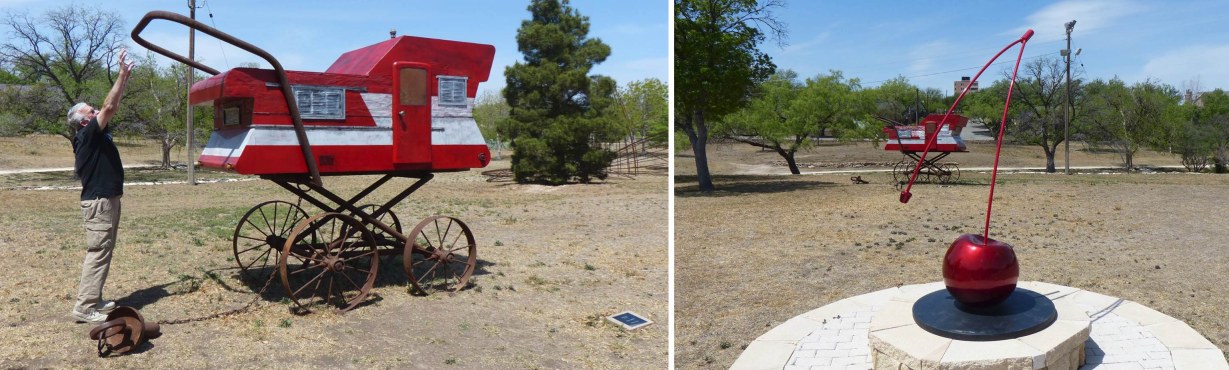 Robbie Barber (Waco, TX) created Southern Comfort #2. Geoffrey Broderick (Abilene, TX) created Cherry Picked.
 Joe Barrington (Throckmorton, TX) created Texas Flora Phil Simpson (Boere, TX) created Cathedral
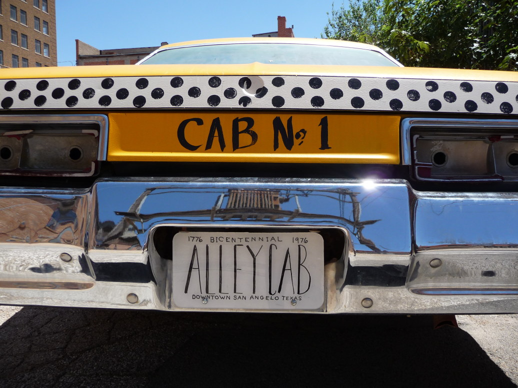
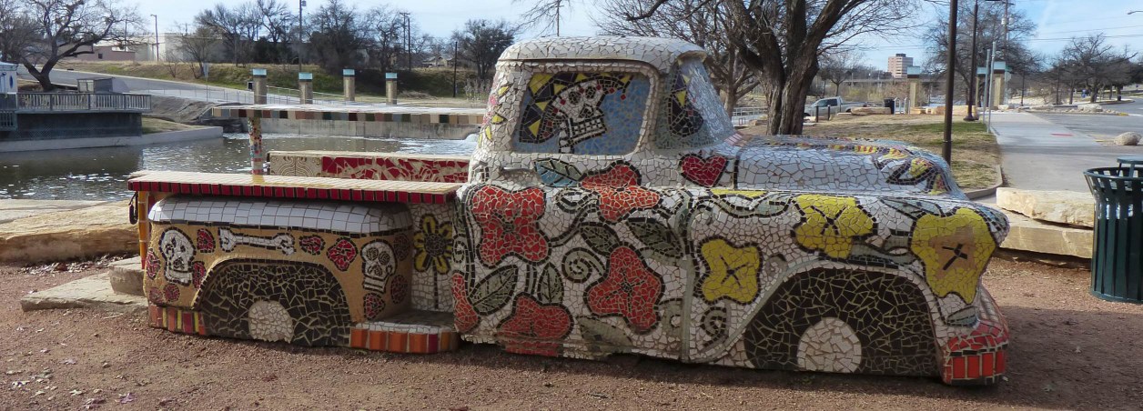
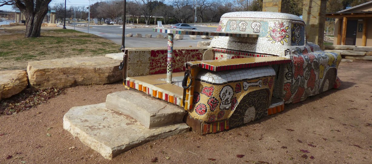
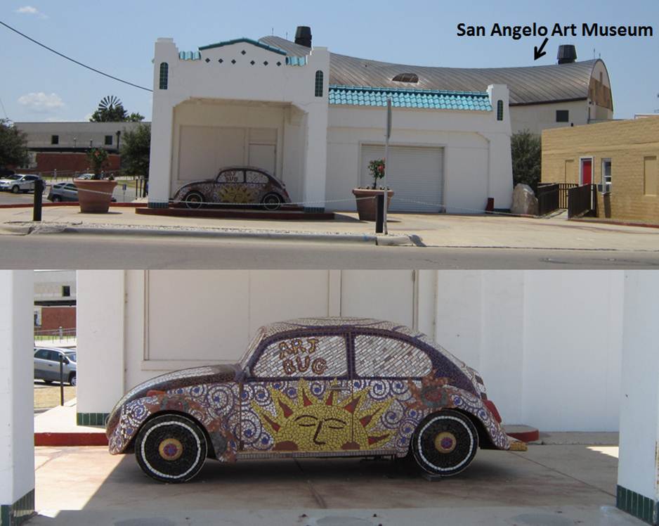 2012 – Car Art found on South Oakes Street close to the Art Museum.
 2012 – This car is now moved to under the bridge by the river (close to the Visitor Center) as part of Art in Uncommon Places.
 2012 – If you don’t know there is artwork “hanging” between two buildings in downtown on Beauregard Avenue, you would miss it. 2016 – We happened to visit the library and I could see the artwork plainly from the street.
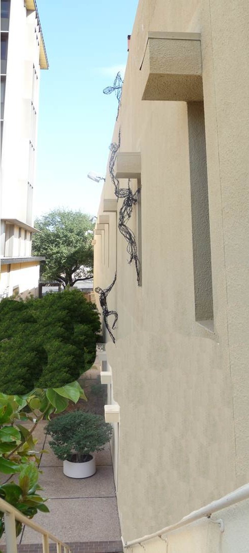
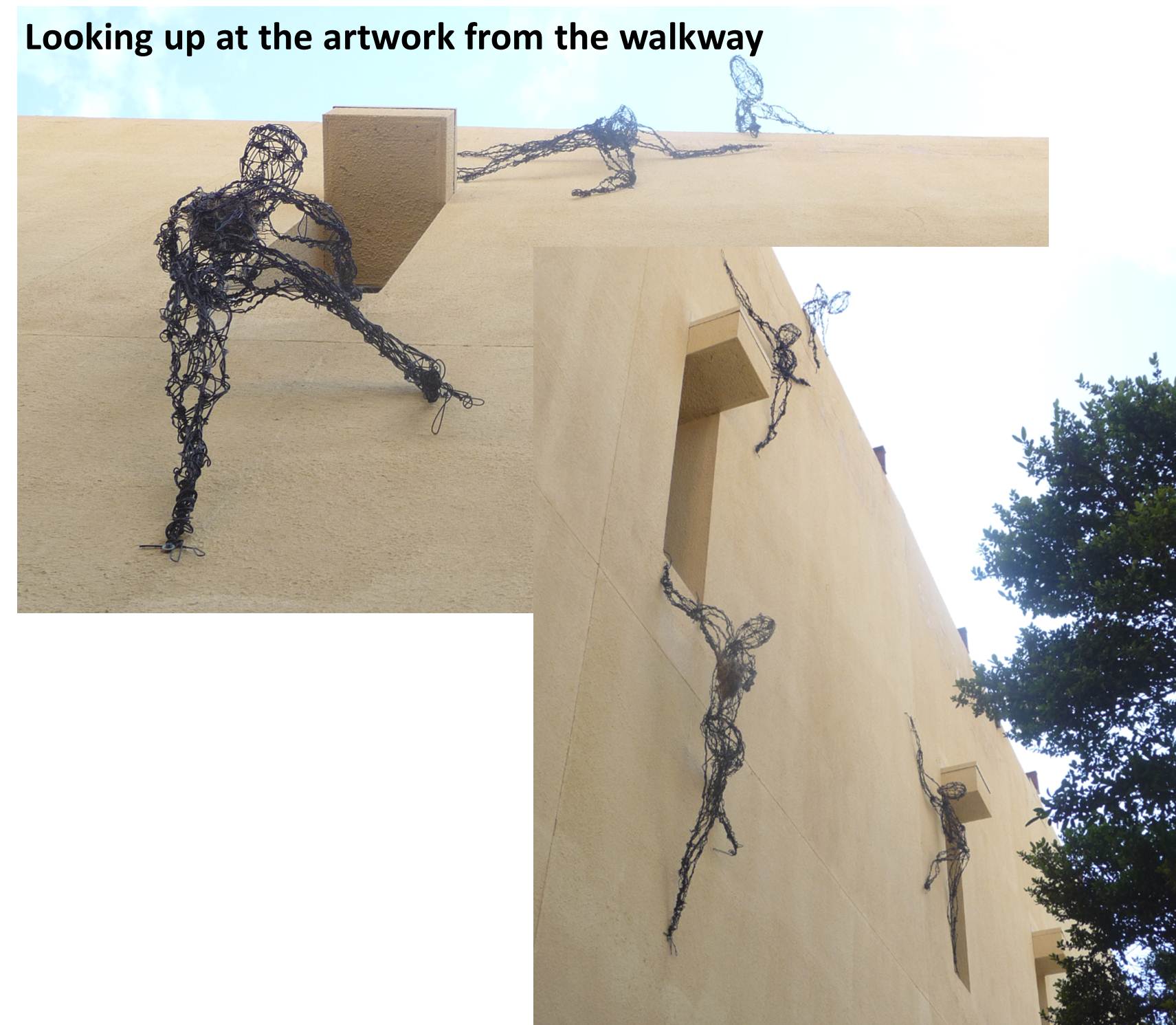 Check out the bird’s nest in the wiring.
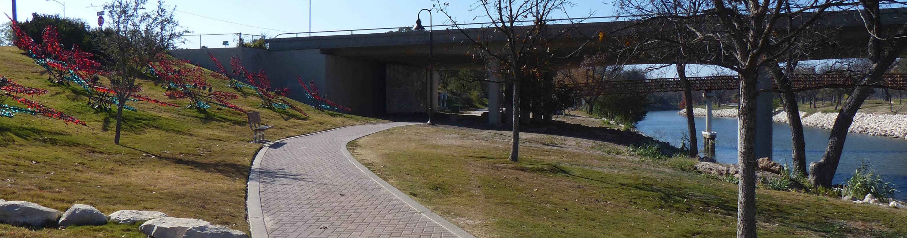 30 November 2012 – Art In Uncommon Places There is a Mosaic painting under the S. Abe Street bridge, next to the Visitor Center. City is getting the Christmas lights set up.
 30 November 2012 – Art In Uncommon Places There is a Mosaic painting under the S. Abe Street bridge, next to the Visitor Center.
 30 November 2012 – Art In Uncommon Places There are three Mosaic art designs under the S. Koenigheim Street bridge. I circled the two you can see in this photograph. The Visitor Center is off camera on your right.
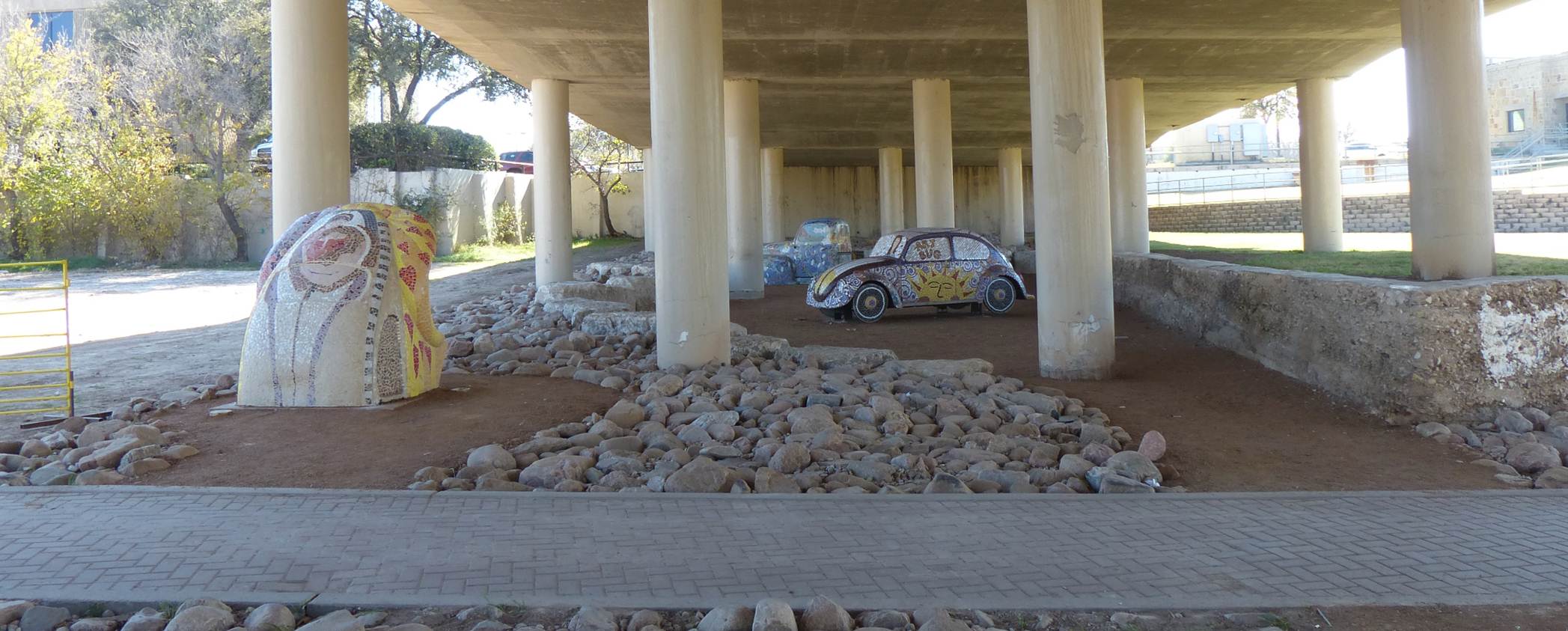 2012 – Art In Uncommon Places
 2012 – Art In Uncommon Places
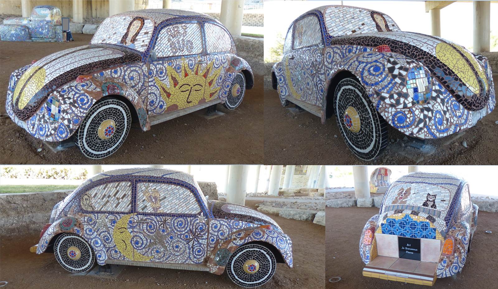 2012 – Art In Uncommon Places Did you notice the feet in the passenger-side window?
 2012 – Art In Uncommon Places

 2012 – Art In Uncommon Places Looks like a VW Beetle half buried. (And the Mosaic art on top of Beetle looks like Madonna and Child to me.) Also, in top photograph you can see the back of the Visitor Center (facing Concho River – off camera to your right).
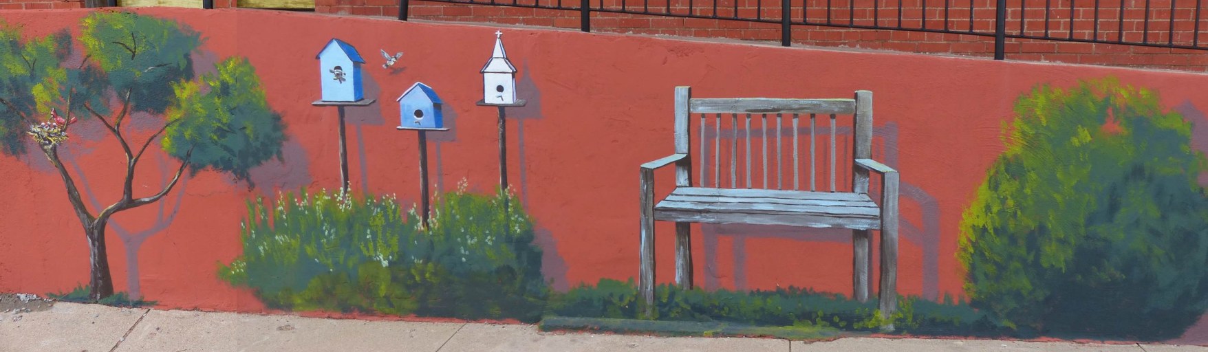
 2013 – Painting on side of building on W Beauregard across the street from Johnson’s Funeral Home.
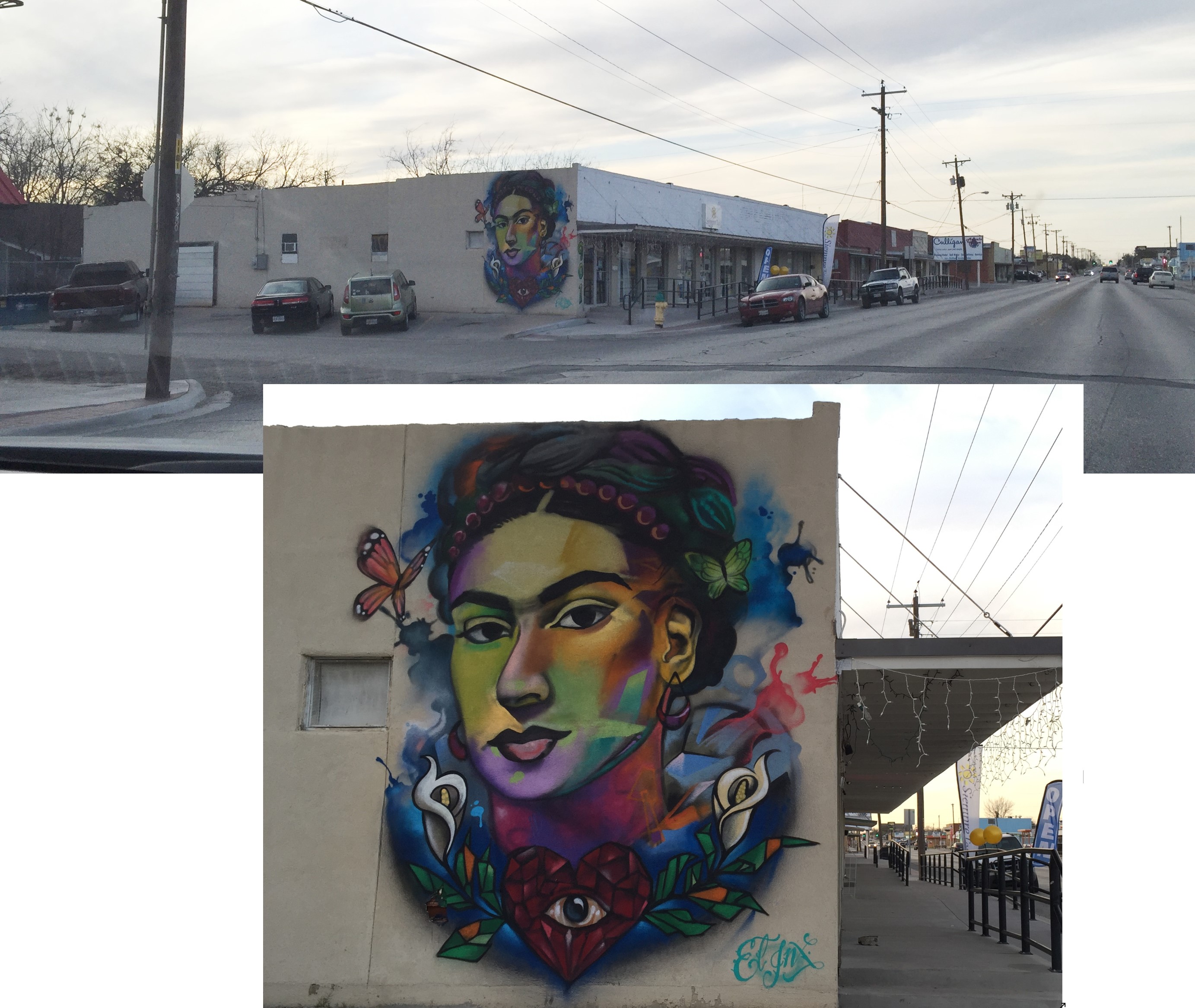
 7 September 2018 – Drove by and had to take a photograph of the great art. Located on W Beauregard Ave.
Photographs provided by Google Map data

Top photograph provided by Google Map data
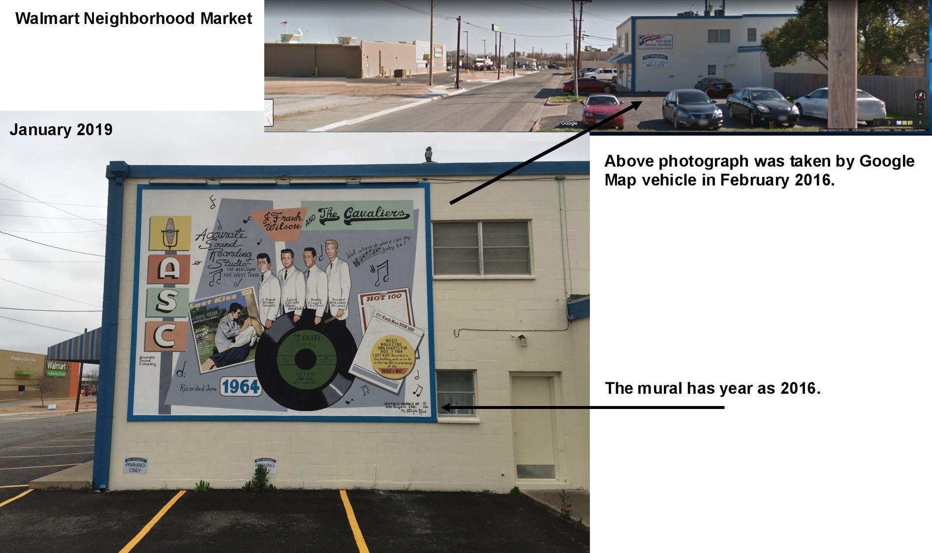 15 January 2019 – Location of Accurate Sound Recording Studio In June 1964, at this location, J Frank Wilson and The Cavaliers recorded their hit single “Last Kiss”.
 15 January 2019 – Location of Accurate Sound Recording Studio In June 1964, at this location, J Frank Wilson and The Cavaliers recorded their hit single “Last Kiss”.
Photograph provided by Google Map data Yellow oval is location of the mural, on the backside of the building. The red oval is where I angled the view on Google Map to get the above photograph dated November 2012. Also, this is aerial view of the Sherwood Way/Beauregard split.
 Vietnam Memorial on Knickerbocker Road by airport. Go to San Angelo, You May Recall section and search for its location – “Now, this is the entrance to the airport.”
 Stone pavers honoring living and deceased veterans who served during the Vietnam Era.
 Stone pavers honoring living and deceased veterans who served during the Vietnam Era.
 Stone pavers honoring living and deceased veterans who served during the Vietnam Era.
Please check out the following link: http://www.vietnam50thcpp.com
Click on PHOTOS/VIDEOS
Under GALLERIES, click on Concho Valley Vietnam Veterans Memorial – San Angelo, Texas. Lew’s and my paver is on page 8 (alphabetical).
 2013 – Ben Ficklin Cemetery with a historical marker.
 2013 – Next to Ben Ficklin Cemetery is a historical marker about Ben Ficklin.
Photograph provided by Google Map data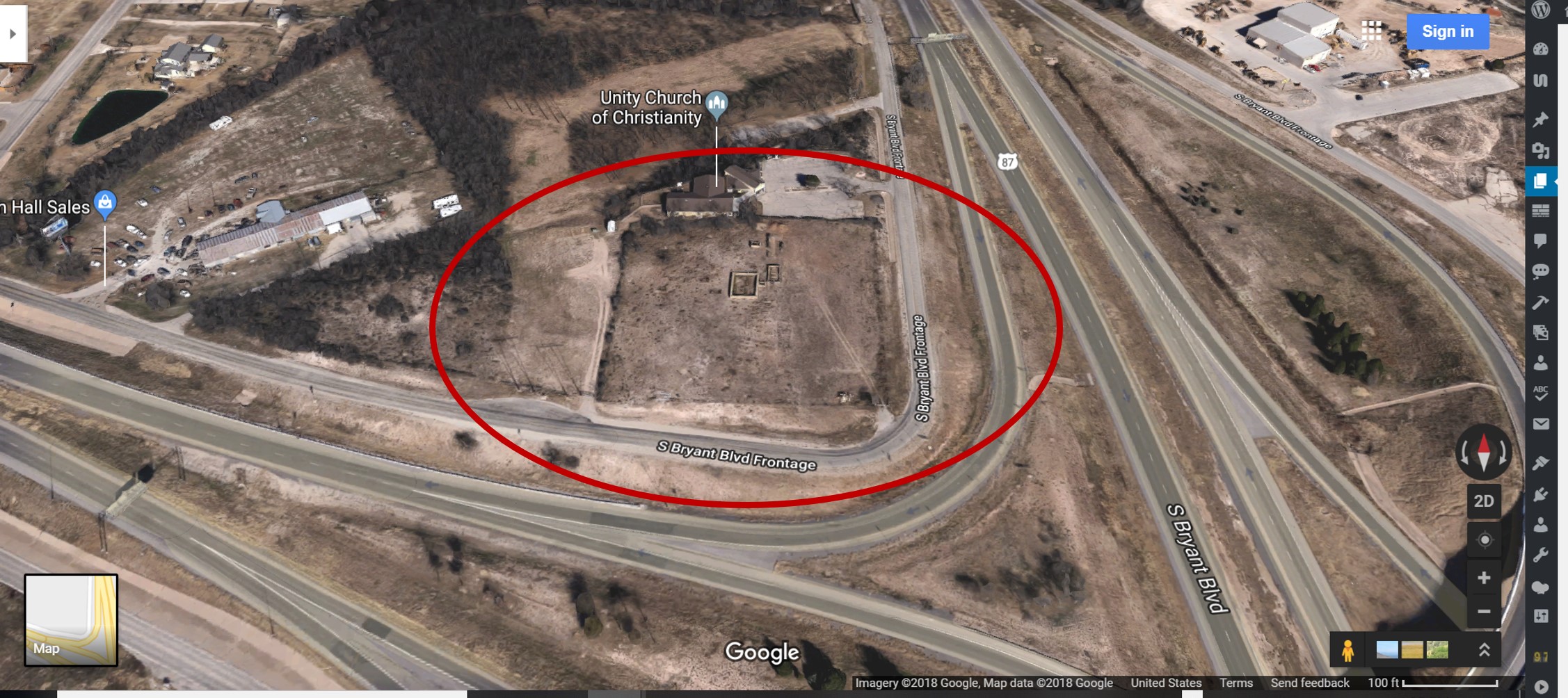
Photograph provided by Find iPhone app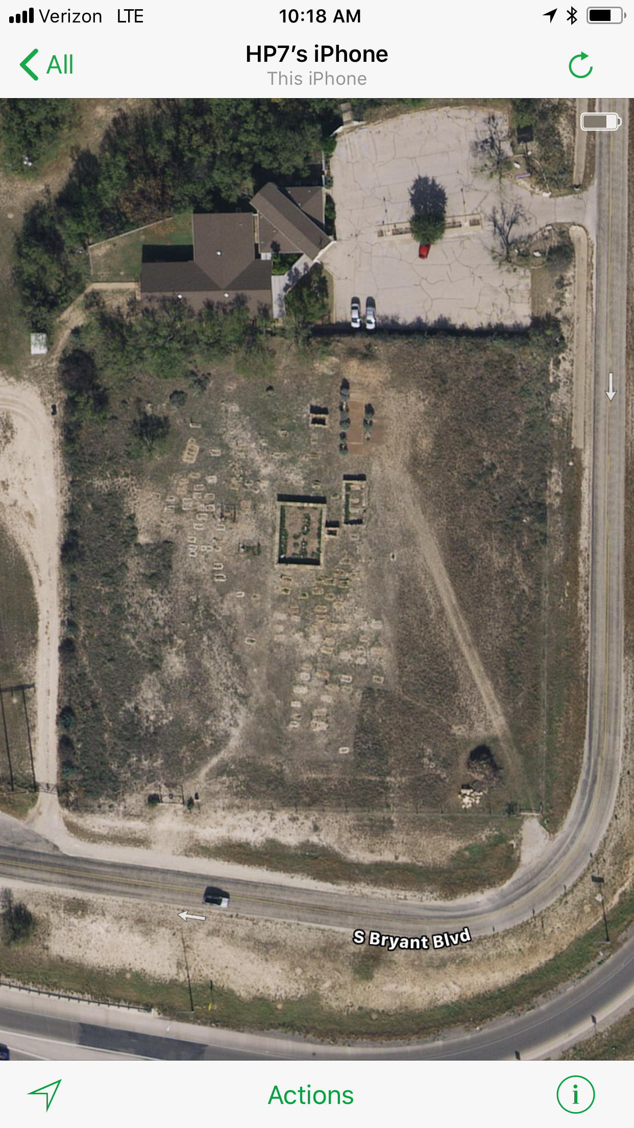
 2015 – Heading towards Grape Creek, Texas A & M University Agricultural Research & Extension is located on N US Hwy 87 (left side of highway).
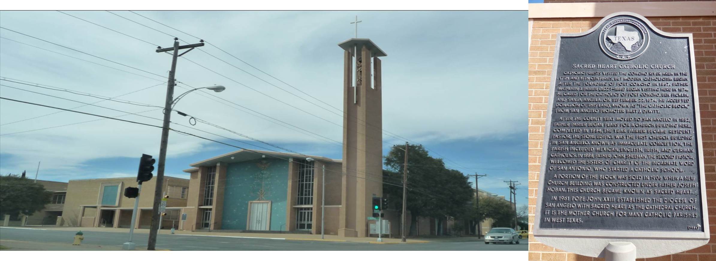 2011 – Sacred Heart (Catholic Church) Cathedral
 April 2013 – First United Methodist Church is located across the street from Sacred Heart Cathedral (above photo – off camera on the right; below photo – off camera right behind you).
April 2014 – This mural is found inside the First United Methodist Church on corner of Oakes and Beauregard. This mural was painted by Sharon Graham Smith.

 June 2013 – Congregation Beth Israel on Beauregard
 2012 – Johnson Street Church of Christ is on the corner of Johnson Street and Victory Lane and next to Crockett Elementary (see on left). The ASU’s Junell Center/ Stephens Arena can be seen at the right in bottom photograph above.
 2012 – The Junell Center at Angelo State University
 2012 – Junell Center Fountain

 2012 – St Mark Presbyterian Church is just to the right of Johnson Street Church of Christ. What is funny is that St Mark lists its address as Johnson Avenue. So, I went to Google Map and it does have Johnson marked as Street and Avenue. The white building in the center of photograph is John Glenn Jr High and San Angelo Stadium can be seen at the right.
 2012 – Baptist Memorial Retirement Services located on the north side of the city.
 Immanuel Baptist Church
 April 2013 – Various banners across Beauregard Street tells of activities around the city.
 26 February 2019 – While I was taking photographs of a sheep for the Ewes Around Town tab, I saw this historical marker at the Texas AgriLife Research and Extension Center at San Angelo on N Bryant/Hwy87 between San Angelo and Grape Creek. Off camera to the left is another historical marker. Please see next photograph.


[/vc_column_text][/vc_column][/vc_row]